Central States, Middle
Nebraska
Nebraska
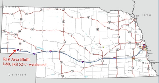
H. I-80: exit 52+/- eastbound rest area. A good place to stretch your legs, or perhaps fit in some cardio should you come across the advertised rattlesnakes. There is a paved path to the west of the restrooms, and a dirt trail to the east. From the top you can get a good view of, Nebraska (in case you forgot what it looked like).
Iowa
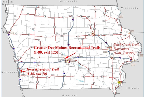
B, D. Iowa, exit 1b. Park at the truck stop of your choice. Iowa Riverfront Trail. Go south over the freeway and into the park. The trail starts behind the info center, winds along the casinos and connects to an artsy-fartsy foot bridge across the Missouri river into Nebraska. There you can continue on the Omaha Riverfront Trail (but I haven’t yet). Back on the Iowa side, we saw kids hauling bagfuls of morel mushrooms from the riverbanks. That’s the fine dining entry. But, I kind of doubt the kids go home and gorge on their mushrooms as if they were Halloween treats. So, there must be restaurants around that the kids sell to.
B, H. exit 125. Park at Love’s (at least that’s what I think it is today). Greater Des Moines Recreational Trails. This is one of the most accessible trails to get to from your truck; just scale the cyclone fence, drop, and roll right onto the trail. Or, I suppose you could take the service road (between Loves and Menards). Rip your clothes on the fence going over and nobody will tease you about being a birdwatcher. Then again, there is the graceful option I mentioned. So, birdwatcher are ya? (I’m having a hard time admitting it myself.) Birds flock to this place. It was a gray day, so grey slabs of ice acted on a conspiracy to flood the creek. As I watched, a few crucial pieces weaved their way into the growing ice dam. With all the black & white and shades of grey (man, I don’t want to offend, who’s turn: “gray,” or “grey?”) blue birds, blue jays, cardinals, red squirrels, and several other eye-poppers screwed with me. Royally. I’d hit the brakes, pull out the camera, focus…and they’d be just a few branches out of range. Not even Photoshoppable. All the pretty colors set against the gray. Ah, well. As Dad says, “at least you saw it.” See for yourself.
B. I-80, exit 292. Park at Flying J. Duck Creek Trail. Coming and going, Iowa has a bike path for you (see above entry). Duck creek trail is a gem that meanders through suburbs and parks thereby skirting most city noises, especially traffic. The place is idyllic and wholesome: high school seniors fold their arms and lean against trees, grandmothers ring their bicycle bells, and no-nonsense squirrels forage. You kind of expect to see Normal Rockwell set up on the lawn. Ask a local how to get to US-67 from the trail if you care to get to the Mississippi. There is a waterfront trail into Davenport starting roughly at US-67 & I-74 (under, of course. Also, there appears to be truck parking at the casino). From Flying J go south on Northwest boulevard, and south on division until Duck Creek Trail, about 3.5 miles all told. To the Mississippi from Duck Creek is about 10 miles (one way); as the crow flies, a little over 6 miles (one way).
Illinois
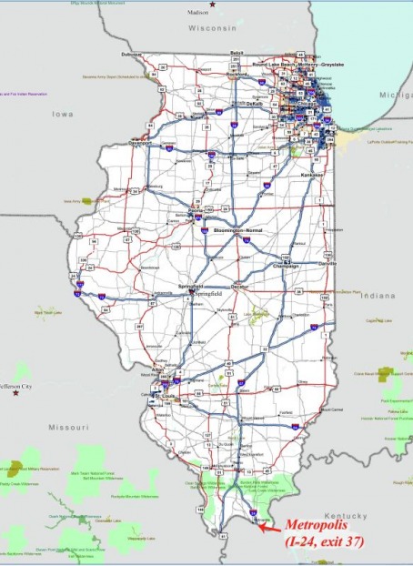
B. I-24, exit 37. Park at the rest area. Metropolis and Superman. Head three miles into town. Metropolis is also home to Big John, another big, mild-mannered fellow. Also, Metropolis is home of Fort Massac State Park on the Ohio River, which I can’t comment on intelligently (why should that stop in this case).
I-295 B, C, D.
Park at Hinsdale Oasis. Chicago, Illinois. Slip out the back, Jack and set yourself free. The back being Birch
Lane, the employee entrance you’ve probably never noticed (I didn’t until I looked). Follow Birch to Woodland Drive, turn left, then right on 55th and left on either Lawn, or Wolf. This will get you to the train station in Western Springs, about 2 miles. There are bike racks there if you are unable to get your bike onto the train. Chicago, of course, is a Slavic word for city of many Slavic folks. Along Archer avenue, for instance, there are many “Polski” businesses. So, I figured Chicago was a good place to get a Chicago style Polski sausage. So, I did. It was good.
Getting off the tollways, and out of the truck really enhances the appearance of Chicago. But I witnessed a miraculous transformation on my maiden bike ride. Until that point, I don’t think I could have been convinced that Chicago was anything other than ugly. Chicago has some beautiful areas. Life is full of surprises.
B, C. I-55 exit 248. Park at Pilot. Turn left out of lot, and bike path starts just after overpass. Keep on path until you hit the I&M
Towpath Trail (Illinois & Michigan canal trail). Nice flat trail along the canal. The I&M canal was a huge deal in it’s time.
It linked Lake Michigan to the Illinois River to the Mississippi River to the Gulf of Mexico. Just hitch your barge to a
couple of horses and away you went.
Kansas
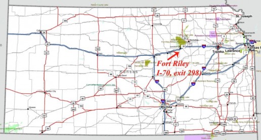
B. I-70, 298. Park at Shell truck stop, Junction City. The bike path is just inside Fort Riley boundary, but before the main gate (in other words, public area - no special pass required). Go north on East street, west on 6th street, north on Washington street. Trailhead/parking area is on the left. Downtown, take a moment to pay tribute to our soldiers in the memorial park.
Missouri
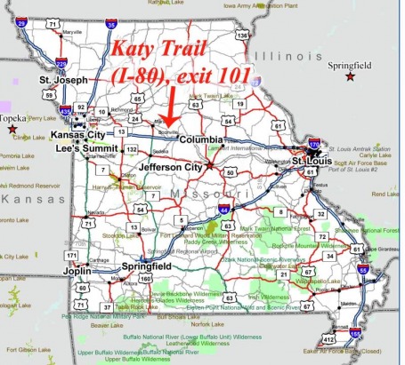
B. I-70, exit 101.Park at Loves. Katy Trail State Park. Head west down the frontage road to the end, up the gravel road past the trailers, and cut across the cornfield onto the trail. (I asked permission, but only for myself, so be sure to do the same if you encounter the landowners. Undoubtedly, there is a better, more official entrance, probably closer to Boonville, but I haven’t been back for awhile.) The Katy Trail is 225 miles long and runs from St. Charles to Clinton, or a majority of the state’s width. It is hard packed gravel, kind of sandy, but not bad. Nice rural farm scenery.
B. I-35, exit 26. Citizens of Kearney, human and otherwise, enjoy a nice bike trail removed from the noise of traffic. One side of the trail is wooded, the other features a crop of something green (in late September). The entrance to the trail is guarded by an enormous Paleozoic-era turtle (I did a little digging and he is a common snapping turtle – which explains his surly behavior towards me); he was in the same spot about a half hour later when I came back through. Further down the trail I got into a staring contest with a deer; I won. He flashed his tail and bounded off. Anyway, head east out of Pilot towards Kearney (as always be extra cautious in Missouri – they don’t believe in shoulders, or road-sharing. Fortunately, there are two lanes and a slight amount of room to make it to the residential street.) Go through the light and turn right onto Regency street. At the end of Regency (a few blocks) turn left. The trail is a block or two on the right.
B. I-35, exit 26. Citizens of Kearney, human and otherwise, enjoy a nice bike trail removed from the noise of traffic. One side of the trail is wooded, the other features a crop of something green (in late September). The entrance to the trail is guarded by an enormous Paleozoic-era turtle (I did a little digging and he is a common snapping turtle – which explains his surly behavior towards me); he was in the same spot about a half hour later when I came back through. Further down the trail I got into a staring contest with a deer; I won. He flashed his tail and bounded off. Anyway, head east out of Pilot towards Kearney (as always be extra cautious in Missouri – they don’t believe in shoulders, or road-sharing. Fortunately, there are two lanes and a slight amount of room to make it to the residential street.) Go through the light and turn right onto Regency street. At the end of Regency (a few blocks) turn left. The trail is a block or two on the right.
