Get Off Here!
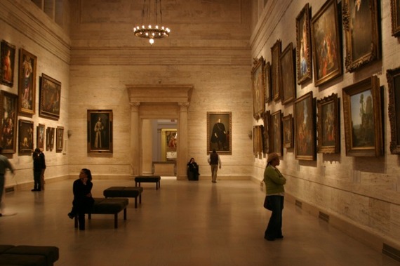
Boston Museum of Fine Arts
This page attempts to describe the various stops that I think are worthwhile. I made cutesy icons to precede each entry, but they didn’t survive the cut & paste to the web. So, I’m going to try an innovative, radical idea: abbreviations. (If you’ve gotten this far you’ve passed the literacy prerequisite.) Here’s the key:
B = Biking. (Usually paved, or hard packed gravel surfaces.)
MB = Mountain Biking. (Strenuous, unpaved terrain. Usually single-track.)
H = Hiking.
C = Cultural. Some legit, some “Americana.”
D = Fine Dining. No fast food, chains, buffets, or food courts unless otherwise noted. However, some restaurants are listed based solely on their cultural appeal.
X= Cross-Country Skiing.
Every entry is within walking distance (a block or two, tops) of suggested parking unless it’s coupled with a biking, mountain biking, or hiking entry. Disclaimer: I make every effort to ensure directions are accurate (well, a half-hearted attempt anyway), but some directions are more general than detailed. Entries are listed by highway number and then exit number and continue into the adjacent state.
Interstate 5
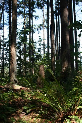 Swan Creek Mountain Bike Park. Tacoma, Washington.
B, MB. Washington: exit 136. Swan Creek Mountain Bike Park.3.55 Miles from Loves. Go south on Pacific Highway (west of the truck stop) for a little over a mile. Turn left on Portland Avenue and climb for approximately a mile and three quarters. Turn left on 44th and at Roosevelt take the street behind the school (not in front of). Slip through the gate and head south east. This is a mountain bike park thoughtfully designed as such. If you find sport in bombing downhill and plowing into hikers from blind corners you’ll be disappointed, otherwise this is the mountain biking equivalent of teenage boys discovering the power of dreaming. Down Karl. The park has the type of signs you’d find on a ski slope – green circle, blue squares, black diamonds, and yellow moons. (The park is small enough to mix and match trails – I rode most of the trails within an hour.)
<
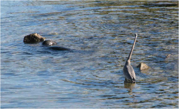
B, MB, C. Washington: exits128, or 129. Wildlife, including seals, herons, and bald eagles in the spring. The brackish water of Chambers Bay is the center stage for all the excitement. The fish migrate from the saltwater to the freshwater and attract interesting predators. Across the street is a nice little path through the woods that is quite a workout; hiking, or
biking. Look for parking off I-5, by all the chain restaurants on Sprague avenue. Take 74th street to Custer rd SW, go west on Steilacoom blvd, all the way down the hill to the city of Steilacoom, take the first through street on the right and take a right on Lafayette which will turn into Chambers Creek road. Follow road until it runs along a little bay and continue until just before the bridge.
Row River Trail. Cottage Grove, Oregon
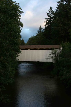
B.Oregon: exit 174. Cottage Grove. Chevron and McDonalds both are supposed to have parking. I can’t tell where one ends and the other begins. Find a truck and park by it (or find one and park as far away as possible, either way). The Row River National Recreation Trail is 15.6 miles of smooth, flat asphalt. There’s covered bridges along with the usual Oregon colors you see when the rain finally stops and the sun comes out. Towards the end of the trail there is suppose to be a mountain bike trail. That’s kinda pushing the amount of time I allot for traveling to a destination.
B.Oregon: exit 119. Roseburg. Park at Loves. Go through the light (highway 99) and continue until you go under I-5. Hooked to the underbelly of southbound I-5 is the Roseburg Trail (or whatever the locals have named it). The trail makes use of existing roads and nonexistent signs. But, it’s a pretty straight shot. First disappearing act is at the fair. Follow the road through the fairgrounds, and take the residential dead end street going north. The trail picks up again and you’re peachy until you get to the stoplight
and high school. Skirt around the western flanks of the school and the trail picks up under I-5 again. Take a right and follow the river away from the freeway noises.
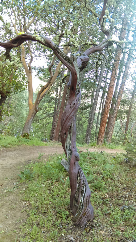 Manzanita Tree in the Britt Woods. Jacksonville, Oregon. Manzanita Tree in the Britt Woods. Jacksonville, Oregon.
B, MB. Oregon: exit 55. Cathedral Hills Park. Finding and parking at Colvin Oil is less tricky than it looks. Take exit 55 going into town take the first left at the light, next left at the stop sign, follow road under freeway and park at Colvin Oil. Cake. (Leaving town be sure to hog the road so you can turn wide at the stop.) Cathedral hills is a flowy, intermediate romp through a manzanita and evergreen forest. Watch for horses and their gifts. There are a few expert runs, which at Cathedral Hills just means a steep climb or decent. MB, B, H. Oregon: exit 45. Rogue River State Park. Park at the rest area. Coming in you’ll cross the bike path. Nice little 3 mile or so path along the river and through the woods that takes you into downtown Rogue River. Quaint little town, with a few appealing looking eateries. Another time. Also, there are some hiking trails along the river, off limits to bikes. Blackberry bushes border the path, but I’d be wary of popping them down your gullet: the eastern side (field side) of the path warns of sewage dispersal. (Explains the brief truck parking lot smell. Really, it’s brief, quickly forgotten and the trail is one of the prettier ones.) . UPDATE: Across the street (ok, interstate) is the trailhead to Mountain of the Rogue mountain bike trail. Carved out of the hillside just a year ago (spring of'15) it is a masterfully planned trail in that it doles out little carrots of descent after each little push uphill. It's not a technical ride, except for some token placements on the trail down, but rather a nice one for bombing down. Plenty of wildlife - I heard them scurrying, although some rustled, and some of the bush displacement noises could have belonged to animals larger than squirrels. I kept moving. More menacing were the mosquitos which are drawn to co2, so try not to breathe. Also, down the road near the California/Oregon border I picked up a tick from ankle high cheat grass. Also, the hill is covered in poison oak ("leaves of three, best not pee," um, 'cause you might be a girl, or, nevermind). So stay away or you will die! Meanwhile in the Klamath Basin, plans are in the works to obliterate cheap power, specifically, the Governor is set to demolish four dams along the Klamath river. Yay for the salmon! (Not being facetious.) To compensate for the lost energy production a massive solar farm will be built that will produce enough electricity to power up to 2,000 homes (Medford: pop 78,500 +/-). Yay for complete disregard for economic ramifications! UPDATE: Exit 48 - Designated truck parking in downtown Rogue River! (First right onto Classick drive, the truck route, follow around. IF that parking is full, there is a wide-spot just before the trailhead. One more past that as well. B, MB, D? Oregon: exits 24, & 33. Medford/Central Point/Ashland, Oregon. Park at Petro, or Pilot. Find the trail just over the curb behind Pilot’s fuel island, or the northeast corner on the auto side (at Petro cross the freeway, and river and there it is on either side). Nice little trail that every once in awhile escapes the droning hum of the interstate. I suspect good eats lurk near the trail. Hope to find out in the near future. UPDATE: The Bear Creek Trail extends from Central Point all the way to Ashland, about 16 miles if straightened out. In the summer, Ashland attracts hordes of tourists who like to pretend they understand English. This phenomenon can be linked to Ashland’s hosting of this country’s first Shakespeare Festival. Maybe I’ll attend someday, but frankly it’s all English to me. But, just past the Theatre in the Round lies the torturous road going up to the White Rabbit mountain biking trails. Mercifully, there’s not a lot of climbing on the trail itself. So, if you got the time and energy to spare here’s how to get there: from Petro jump onto the Bear Creek trail until it ends in Ashland on Helman street. Take Helman to Main and follow into town. Turn At the town’s epicenter onto Pioneer and gawk at the Theatre. Turn onto Fork street and follow it although it looks like it becomes an alley. Fork will dump you onto Glenview drive. Follow Glenview until you find Ashland Loop road. Stay on Ashland Loop as it becomes gravel and stay on it until you’ve shed 3 or 4 gallons of sweat. You should arrive at the trailhead before hallucinations get to be severe (assuming you’re in shape, hydrated, and the ambient temperature is below 100°). If you come across a mirage that looks like a parking area, that’s the trailhead. Avoid Alice in Wonderland (or BTI off of it) unless you have superb brakes, and are ready to leave. UPDATE: 5 miles to Jacksonville and Britt Woods from Withram "truck stop" a relic on life support (restaurant & bar with regulars) from another era. Weathered Manzanita trees, twisted, smooth, red, enchant this trail. MB, C. California: exit 773. Greenhorn Park. Yreka, according to Mark Twain (according to Wikipedia) is named not after the native word for White Mountain, i.e., Shasta (the mountain, not the widely swilled discount cola of the ‘70s) but for the reverse image of a sign dangling from a bakery, minus the presumably torn off “B” – Yreka! Anyway gold was found there and a town sprang up. Couldn’t possibly be that there was already a town named Eureka in California (just over yonder) and the learned folks figured the one letter brevity would get them a higher listing in the yellowed pages? Anyhoo, exit 773 north or southbound, turn right at the light, left at the next street and park on the street. (Alternately go straight through the light, but exiting town is easier the former way.) Trailhead is to the north behind the college parking lot. MB, D. California: exit 736 (or better yet, 737 northbound). Enter from south of the city so you can park on the east side of the street (I usually park just north of the Thai restaurant). Ride through the city, past the park and the high school and Gateway Trails trailhead is 9/10ths of a mile past the high school. Nice curvy, banked singletrack gently winding higher and higher up the hill. (I haven't had the opportunity to explore further than what an hour and a half roundtrip will allow. Someday. Soon, I hope.) The City of Mt. Shasta, population less than my eight fingers and two opposable thumbs, boasts TWO Thai restaurants. Haven't tried either yet, just tossing factoids about. Seven Suns on the other hand (ignore the fact I used both hands in the previous sentence) has damn fine coffee according to my wife. (Internet reviews claim the Thai restaurants are good too.) Mount Shasta can yield photographic keepers, but from the trail it's a little like sitting in the front row at an IMAX movie. UPDATE: "No truck parking" sign spotted just before Thai restaurant. Not sure if it's for that block only, or for in town. Only spotted the one sign, so... maybe safer to park further south 'til I get if figured out. . H, B. California: exit 726. Park on the shoulder, plenty of room. Pacific Crest National Scenic Trail. To the west of I-5 is the Pacific Crest Trail, to the east paved, turning to dirt roads into the hills. Both beautiful. The PCT (as forest service rangers inelegantly refer to it) runs from the Canadian border in Washington to the Mexican border in California. Obviously, you commit to hiking the whole thing or not at all. (Fine, do it your way, I don’t give a …) Anyway, this segment of the trail leads to a picnic area complete with a telescope for the picture-postcard views of Mount Shasta and Castle Crags. (While I was there an impromptu tutorial broke out on how to couple an inexpensive point & shoot camera with a telescope to produce zoom-lens photos. “Just put the lens up to the eyepiece; it really works.”) The uphill hike took me about an hour at a very brisk pace. No big tragedy if you don’t have the time, or energy, to get to the top; it’s pretty much the same view you see for miles as you approach Shasta. |
Castle Crags State Park, California
H, MB. California: exit 724 (I think. Left my notes in the truck). Park at the Chevron (I think. See previous). Always kinda suspected you could park up there comfortably; you can. As opposed to the previous exit, Castle Crags State Park allows bikes. Take the main trail if you know what’s good for you – Bob’s Hat (or something like that; again, original excuse covers this) is straight up with virtually no rest, or switchbacks even until the top. I like unending pain as much as the next guy, but…Oh, speaking of unspeakable pain (ha, don’t mention it), the park folk advise against sneaking up on cougars. And ’11was a wet winter, so slather up with the DEET too. Update: Main trail peters out, disappears, you'd need an Indian scout and hound dogs to find it. So, Bob's Hat it is, or take the paved road up and proceed from there. Or, ask the ranger for directions at the park entrance.
H, MB. California: exit 724 (I think. Left my notes in the truck). Park at the Chevron (I think. See previous). Always kinda suspected you could park up there comfortably; you can. As opposed to the previous exit, Castle Crags State Park allows bikes. Take the main trail if you know what’s good for you – Bob’s Hat (or something like that; again, original excuse covers this) is straight up with virtually no rest, or switchbacks even until the top. I like unending pain as much as the next guy, but…Oh, speaking of unspeakable pain (ha, don’t mention it), the park folk advise against sneaking up on cougars. And ’11was a wet winter, so slather up with the DEET too. Update: Main trail peters out, disappears, you'd need an Indian scout and hound dogs to find it. So, Bob's Hat it is, or take the paved road up and proceed from there. Or, ask the ranger for directions at the park entrance.
C, H, B. California: exit 595. Northbound, park on extra-wide shoulder just before refuge entrance. Southbound, park on entrance shoulder. The Sacramento National Wildlife Refuge is the largest in a complex of gated communities in the Sacramento valley. It has every amenity a travel-weary bird could want (with the exception of cultivated rice, which is just a few flaps away). If it sounds a bit too perfect, it is: it’s all manmade. Because it was 90% man-destroyed: blame the farmers and sushi-eaters if you must, but birds really love the rice fields (no harm no fowl, unless it’s hunting season.) Anyway, it’s a nice re-creation and many animals live there (300 some species). During my brief tour I encountered a pair of deer, and what I thought were another pair of very small deer, but then they raised up on their haunches, so obviously SNWR is also home to the elusive jackelope (the picture didn’t turn out). If those pair of rabbits (if that’s what they were) had attacked President Carter, there would be no Habitat for Humanity.
Sacramento National Wildlife Refuge, California.
MB. California: exit 176B. Park at Pilot (if possible – parking’s pretty competitive being it’s the last truck stop before LA. There is some street parking too). Castaic Lake State Recreation Area. Go north out of Pilot on Castaic road, right on Lake Hughes road, left on Ridge Route road, and right on Castaic Lake drive. Go thru the park’s main gate, turn left and stay on the left hand road. Just past the maintenance/dump area is the path and about 50 yards on the right is the single-track trail. B. California: exit 152. HOLLYWOOD!
B. California: exit 152. HOLLYWOOD!
I-10
MB. California: exit 61. Park at one of the truck stops. Jurupa Hills Regional Park. Go south on Cherry street, left on Live Oak Avenue. Behind the city park is the regional park. Trail is off to the right (sw). This approach is pretty steep and I do a lot more hiking & pushing than I’d like to admit. Another, mellower approach is to turn left (east) on Jurupa and enter at the park there on Sierra (& Jurupa). I haven’t explored that way much, but somehow it connects and you end up at the park on Live Oak. (I’ll work on better directions next time I’m there.) Minor Update: When you reach the dirt road heading east, go up it just shy of the paved road and the trail will resume and loop back around the mountain. Another Update: Southridge is the mountain bike trail. Since I first posted this gem, Google has mapped nearly every speck of this particular planet. That being said, despite the fact that it hosts regular races, it is frustrating to find the trails at first. Use MTBproject.com, or one of the other apps to help you find the trail. Flying J apparently has acquired one of the truck stops there on the corner.
MB. California: exit 61. Park at one of the truck stops. Jurupa Hills Regional Park. Go south on Cherry street, left on Live Oak Avenue. Behind the city park is the regional park. Trail is off to the right (sw). This approach is pretty steep and I do a lot more hiking & pushing than I’d like to admit. Another, mellower approach is to turn left (east) on Jurupa and enter at the park there on Sierra (& Jurupa). I haven’t explored that way much, but somehow it connects and you end up at the park on Live Oak. (I’ll work on better directions next time I’m there.) Minor Update: When you reach the dirt road heading east, go up it just shy of the paved road and the trail will resume and loop back around the mountain. Another Update: Southridge is the mountain bike trail. Since I first posted this gem, Google has mapped nearly every speck of this particular planet. That being said, despite the fact that it hosts regular races, it is frustrating to find the trails at first. Use MTBproject.com, or one of the other apps to help you find the trail. Flying J apparently has acquired one of the truck stops there on the corner.
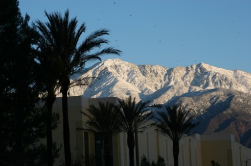
Not Jurupa Hills, but San Gabriel Mountains as seen from Rancho Cucamonga. Close enuf.
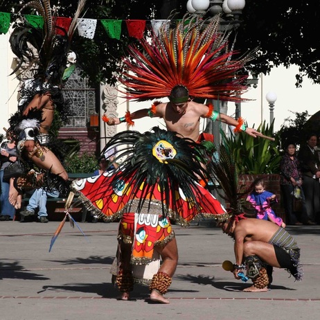
Aztec Dancers. Olvera Street Plaza, Los Angeles.
C, D, B, H. California: exit 61, or 57. Pick a truck stop. Los Angeles via Metrolink train. $22.00 for a roundtrip ticket from Fontana to downtown LA. Ticket includes bus transfers on LA Metro buses; I jumped on the 733 which is an express to Santa Monica, the pier, and the beach. The trainride ends at Union Station, which is suppose to be the last of the great trainstations. Built in 1939, Union Station is a popular movie set; in fact, they were filming a music video when I arrived. Across the street billiantly feathered Aztec dancers leaped about for us tourists. So, I felt obliged to snap off a few shots. After capturing the local color, I stolled down Olvera street, between the oldest buildings in LA, and settled in at La Golondrina restaurant. I took the waiter’s recommendation and avoided the temptation of a stereotypical choice. Stuffed, I staggered to the bus end of Union Station and hopped on the bus. It was late, the sun was going down, and I thought, I bet nobody’s ever taken setting sun shots from Santa Monica. So, I found a place in line and took my share of cliched sunset pics. I rode my bike to the train station, but the 82 (Omnitrans) goes there too. By bike to Fontana station is about 4 miles. To the Rancho Cucamonga station it’s a little over 1.5 miles from TA (I haven’t figured out by bus yet).
C, D, B, H. California: exit 61, or 57. Pick a truck stop. Los Angeles via Metrolink train. $22.00 for a roundtrip ticket from Fontana to downtown LA. Ticket includes bus transfers on LA Metro buses; I jumped on the 733 which is an express to Santa Monica, the pier, and the beach. The trainride ends at Union Station, which is suppose to be the last of the great trainstations. Built in 1939, Union Station is a popular movie set; in fact, they were filming a music video when I arrived. Across the street billiantly feathered Aztec dancers leaped about for us tourists. So, I felt obliged to snap off a few shots. After capturing the local color, I stolled down Olvera street, between the oldest buildings in LA, and settled in at La Golondrina restaurant. I took the waiter’s recommendation and avoided the temptation of a stereotypical choice. Stuffed, I staggered to the bus end of Union Station and hopped on the bus. It was late, the sun was going down, and I thought, I bet nobody’s ever taken setting sun shots from Santa Monica. So, I found a place in line and took my share of cliched sunset pics. I rode my bike to the train station, but the 82 (Omnitrans) goes there too. By bike to Fontana station is about 4 miles. To the Rancho Cucamonga station it’s a little over 1.5 miles from TA (I haven’t figured out by bus yet).
C. Arizona: exit 17. Park at Pilot. Quartzite, Arizona. The claim is the world’s largest swap meet. World’s largest RV parking lot anyway. Cynical ‘cause I haven’t explored yet. Intend to. UPDATE: “Coprolites!” I stage bellowed sauntering towards the display of petrified crap, “You’re shitting me.” This forced a smile, genuine or indulgent I’m not sure, from the gentleman perched beneath the sweat-stained cowboy hat. So we shot the shit about coprolites, rocks, fossils, and geology. Naturally I bought a handful of his coprolites from the Colorado plateau and I plan to hold onto them (there, I knew it wouldn’t be much of a strain to drop an anal retentive reference, sorry).
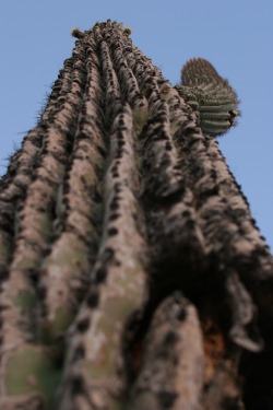
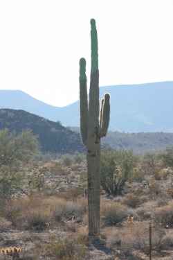
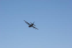
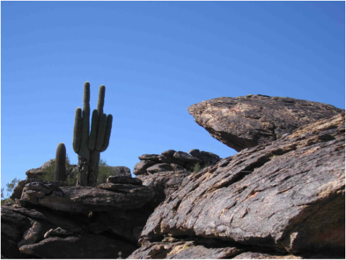
MB. Arizona: exit 114. Park at Loves. I finally got my saguaro cactus picture. The sun was low in the sky – nearly perfect conditions. I pulled to the side of the highway, hiked a truck length down the shoulder, composed a stereotypical shot, and was then buzzed by a cargo plane straight out of Raiders of the Lost Ark. Really, truly buzzed – directly overhead, very low altitude. Then it banked gracefully over the freeway as if I was shooting with a super-8 camera instead of an SLR. Welcome to trucking: hours, days sometimes, without much of interest and then something spectacular happens and no one is around to say, “Did you see that!?” But, I got my cactus picture. Not there though. Just up the road from Loves there are lots of cacti in ready-made poses. So again I set out to get my picture. On bike this time. I pass under I-10, past all the cars stacked up on the off-ramp, past the tractor-trailer parked off the side, and just as I start down the dirt road a pick-up truck brakes in the middle of the road and stares me down. Doesn’t say anything, just fixes me with his droopy eyes. “O.k., pardner” I think, and ride over to learn of my transgressions. The closer I get the less he looks like Deputy Dawg. “This is a private road. It’s clearly marked.” “Not so far,” I point out. “Just over the hill it is, and further down is the air force base,” which, his solemn tone implied, is where Air Force snipers are just itching to light up wayward bicyclists with their .50 calibers. So, I asked where I could ride safely and he grudgingly pointed to the first dirt road on the left (Tonopah-Salome Highway, yes! the dirt road). After a while I veered off under the power lines and found a few trails that led to some majestic cacti. I must have veered off of that path too ‘cause I found a few thorns in my tires the next day. So, watch out for thorns.
Heads up in Arizona.
|
MB, C. Arizona: exit
162. Park at Loves. Disregard exit 114 (unless desperate). South
Mountain Municipal Park (in Phoenix) is the largest municipal park in the
country (I’ve been to smaller national parks). Approximately 6 miles to
trailhead. I rode the Mormon Loop, failed to loop, went down Mormon and
ended up on 24th (street/ave/blvd/who gives a crap what comes after
24th). No complaints, the ride/walk was exhilarating; the hike back
up was spectacular. “I thought you would have been long gone,” the hiker said
as he overtook me. National Trail at the top of the hill could be a less
strenuous alternative. Minor UPDATE: National Trail to the left makes for a longer, less strenous ride. But, taking Mormon to 24th street is spectacular. Do both, call in sick (or, to paraphrase George Carlin, call in well, as in, "I'm feeling too good to come in to work today").
Wild Horse Casino across the highway from Loves also has truck parking. It also offers fine dining and drinking establishments within. A natty gentleman struggling to stay perched upon his barstool piched his internet cab service too me. Catching spittle with a backhanded swipe demonstrated that no small detail was unimportant. Sadly, I had to decline his invitation. |
South Mountain Regional Park. Phoenix, Arizona.
To get to South Mountain from Loves ride north to Chandler, then left (west) to 48th and right (north) to the intersection of 48th& Guadalupe (the sign lurks amongst folliage, but the road curves and changes names there). Enter on the road that looks like an entrance to a country club. Trailhead at the end of the road. |
B, C. Texas: exit 37. Park at Petro? (You think I’d learn about taking notes. Anyway there’s a Loves? across the street too.) Socorro Mission Trail. The Socorro Mission, originally built in 1682, and rebuilt (late 1700s?) after the Rio Grande flooded is a fine example of that type of architecture (ha, sounds like an answer to a 7th grade essay question). Anyway, as the name suggests there are other missions to explore too.
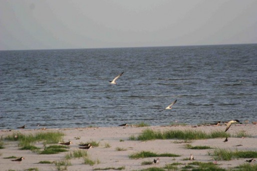
B, C. Mississippi: exit 44. Park at Loves (formerly Pilot). Biloxi, Mississippi and the Gulf Shores. Beautiful white sandy beaches are home to least terns (birds). These birds remind me of surfers paddling furiously to catch a wave; they similarly flap laboriously against the wind, then turn into it and soar on just the slightest sea-breeze. Mesmerizing. Across the street (literally) is the home of the Confederate President, Jefferson Davis. Historically significant, I’m sure, but it seems a little bland. There is a nice stretch of boardwalk (concrete) for cruising along the beach. The terns only monopolize a small section of beachfront (they’re protected) which leaves plenty of beach for human activity. Oh, and US-90 runs right by the beach, and it is possible to bobtail right to the beachfront. (Another trucker did just that.) So, head left out of truck stop on Cedar Lakes and turn right on Popps Ferry road up and over the draw bridge (cross on the east side to get out of the traffic). Take a left at the light and a right at the next intersection (or just follow the signs to the beach). From Loves to the beach is about six miles.
Terns on the beach. Biloxi, Mississippi.
B, C. Louisiana: exit 239. Park at Big Easy truck stop. (Or at exit 236 Mardis Gras truck stop which I found accidentally before my delivery, but couldn’t find when I wanted to spend the night.) New Orleans. The roads to the French Quarter are mostly tree-lined and flat making the ride pleasant and (big) easy. Don’t get offended by the yellow tinged American flags: they’re not American flags, nor do they represent any sort of political statement. Further description would ruin your aha moment. Katrina aftermath is still obvious in some neighborhoods, but the Big Easy is nowhere near dead in the French Quarter. From Big Easy truck stop take a left out of lot on Gentilly road and follow until it turns into Bayou road and then follow that to Esplanade street which is the eastern boundary of the French Quarter. Under 5 ½ miles to French Quarter.
B, C. Louisiana: exit 239. Park at Big Easy truck stop. (Or at exit 236 Mardis Gras truck stop which I found accidentally before my delivery, but couldn’t find when I wanted to spend the night.) New Orleans. The roads to the French Quarter are mostly tree-lined and flat making the ride pleasant and (big) easy. Don’t get offended by the yellow tinged American flags: they’re not American flags, nor do they represent any sort of political statement. Further description would ruin your aha moment. Katrina aftermath is still obvious in some neighborhoods, but the Big Easy is nowhere near dead in the French Quarter. From Big Easy truck stop take a left out of lot on Gentilly road and follow until it turns into Bayou road and then follow that to Esplanade street which is the eastern boundary of the French Quarter. Under 5 ½ miles to French Quarter.
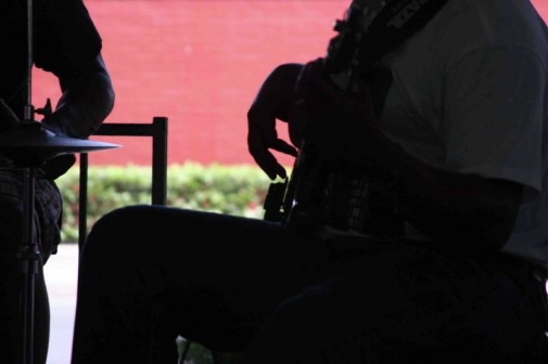
The On Time Band
New Orleans, Louisiana
New Orleans, Louisiana
I-11
MB, D, C, D. Nevada (just north of Arizona). Park in the parking area across from Hoover Dam Lodge & Casino. Look both ways, like your mother advised, then cross the highway to the sw corner of the HDL&C parking lot, then almost under the heliport is the trail to Hoover Dam. I suppose you could hike it, but biking is light years faster. Bighorn sheep populate the area and I have seen them (when driving). Of course, Lake Mead dominates the landscape to the west. Probably not much that I can add that hasn't already been said about the monumental achievement of the damn. Did have a standoff with a pair of bugs on the way back - really! They charged me, waving menacing antennae.
Had the cheapest breakfast I could find on the menu post-ride and it was still enormous. With coffee, less cheap. Ah well. Gold Strike Hot Springs trail is on the east side somewhere and sounds exhilarating. Bootleg Canyon is about 5 miles from HDL&C. I look forward to updating these latter two excursions. UPDATE: Five gentle, but relentless miles uphill from the Casino is indeed the trailhead to Bootleg Canyon. Bootleg Canyon trails are not so gentle. For instance, on Girl Scout (marked green circle for easy) I failed to negotiate a few rock outcroppings. Had to dismount. Humiliation. BUT! I got ahead of myself. On the journey to the trailhead I noticed a parking area much closer to town. I copblocked the patrol car and asked the officer if I could park all of my eighteen wheels in the lot. He said probably, but better yet why not park on Industrial Road (which is damn near at the trailhead, is easy in/out onto highway 93).
UPDATE: Park at the Railroad Pass Casino/Truck Stop (no, really!) at the beginning of the expansive new Interstate 11, (all two or three miles of it). The truck stop section is so new it doesn’t yet show up on Google (as of August 2018). Look for Earnie’s Trail just after you cross the railroad tracks on the paved bike trail.
I-15
H. Idaho: exit 105. Rest area. Hawaiianesque lava flows with educational stops along the way. Paved, gentle 3/4 mile loop. A nice break from the usual rest areas and a good place to stretch the legs.
B, MB. Utah: exit 343. Park at Flying J. Who the hell knows how far the Bonneville Lake Shoreline Trail stretches? I looked it up online, but this particular section wasn’t yet listed (I assure you it’s there). Anyway, the BLT (if the Forrest Service were to name it) roughly follows the ancient Bonneville Lake shoreline and runs in several other places, such as Salt Lake City (more on that later). It’s scenic, especially in the fall, and a nice ride. You do have to ride about a half hour through town to get there, but if you have the time you’ll be rewarded. So, to get there head east on highway there (UT-104) until it dumps out onto city streets, roughly 20th. Turn right on Wall (south), and left (east) on 24th. Follow up the hill and behind the school is the trailhead. (I’m sure there are several other entrances too.) UPDATE: There is a nice work-in-progress bike trail starting just after you get over the first overpass (just past the landfill). A fishing/skiing pond/lake is where to set your sights. The completed portions of the trail are gorgeous and sculpted around the river. I got off the trail and headed downtown to the Union Grill, in the Union Station (what were the odds). This I did on foot, and it pooped me out, but it can be done. I ordered salmon, which came with bread pudding. Ok, what the hell I’ll try it, I thought. Man, I didn’t know bread pudding could taste like that. It was beyond edible, it was delicious!
B. Utah: exit 4. Park at Flying J. Head north out of FJ a block or two, onto the dirt path under the billboard (coincidently depicting a bike-riding greeter to Utah, or St. George, or Utah’s National Parks, or something wholesome) and continue until the path meets the paved trail. The system is fairly extensive and for the most part flat. To the right the trail hugs the side of the hill where picturesque boulders tenuously balance above your head. Bring a camera for protection (my experience has always been that a ready camera staves off spectacular events; the corollary, of course, is ditch the camera if you want newsworthy. UPDATE: Turtle Wall Trail. If you can, park at the tiny little truck stop at exit 10. Head northwest on Bluff road (via St. George boulevard if coming from exit 10) and the trail parking lot is on the left just past the Snow Canyon Parkway. Slick rock trails wind around plenty of red rock boulders, cliffs, and the occasional desert tortoise. (The rocks are smooth, not slick: the moss covered rocks near the Great Smokey mountains are far slicker.) UPDATE: Zen Trail ROCKS! Lots of them: small, medium, condominium-sized. All hard as nails, or rocks. Even the fire road climb rocks, lower case, but still! (And its over quick enough.) Zen rhymes with Ten and Nine rhymes with Nein because there’s no perfection (especially since I lost the trail towards the end). Boring details: I logged over 23 miles roundtrip, which according to Mountain Bike Project combined with Google Maps is eight more miles than necessary (9.2 round trip commute, 5ish trailside).
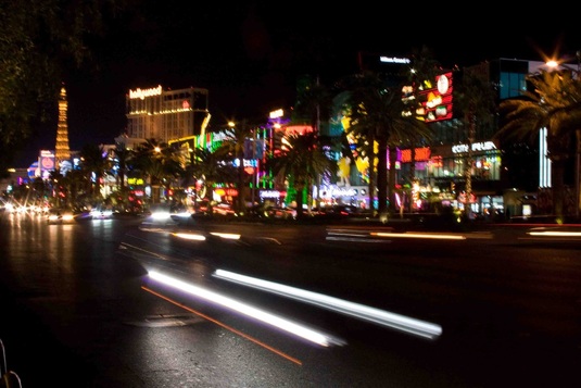 The Strip. Las Vegas, Nevada.
C, B, MB. Las Vegas! Nevada: exit 38 (West Tropicana Road exit). Park at Wild West Casino (Truck Stop). Drive past In-N-Out & then just past Wild West Casino & truck stop is on right (there’s also parking in Motel lot across from In-N-Out, but may want to check with motel desk in casino to be sure). Walk east across sidewalk south of Tropicana and assuming the trolls under the bridge let you pass (people literally perch under the poorly-lit bridge completely shielded from the nearby throngs of humanity; seriously ladies, buddy up, or taxi up) you’ll find yourself smack dab in the heart of the strip. Once past the trolls you’ll be in the glow of the Excalibur with New York, New York across the street and MGM down the block. You should probably know what to do from here.
Blue Diamond trails. The Blue Diamond Mine is roughly a half mile past the town of Blue Diamond. I loaded gypsum at the mine three miles uphill (10% grade maybe, guess based on recently driven 10% posted grades). It literally took less time (a lot less) to load than it did to travel back downhill.
The week before I spent a 34 hour break in the area (if you’ve read this far you may have guessed). Anyway, I spent most of that morning researching where to ride, the rest of the morning and early into the afternoon getting to a taxi (in Summerlin), a scant 10 miles (and $20.00 more) to arrive seven miles short of my destination, and the rest of the afternoon riding back to the truckstop: 30 some miles roundtrip with slight detours. So, plan better than I did (probably catch the bus at Sahara & then a taxi to the town of Blue Diamond). Or, from the TA (exit 33) bobtail to the Chevron and ride your bike 3 miles to the town of Blue Diamond. OR, maybe since the trail itself doesn’t seem all that demanding, you could experiment with pedaling from the TA to Blue Diamond (about 13 miles slightly uphill to the trailhead).
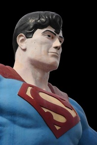 Man of Steel (or concrete). Metropolis, Illinois.
I-20
MB. Texas: exit 562. Tyler State Park.
I-24
B. Illinois: exit 37. Park at the rest area. Metropolis and Superman. Head three miles into town. Metropolis is also home to Big John, another big, mild-mannered fellow. Also, Metropolis is home of Fort Massac State Park on the Ohio River, which I can’t comment on intelligently (why should that stop me in this case).
B, H, D, C. Tennessee: exit 48. Park at the TA (and be sure to check out their flood pictures in the hallway). Nashville is about the easiest city of size (it’s a big city, but I don’t want to offend) to explore. For less than $7.00 you can take a cab from TA to Music Row. (But, if you absolutely insist on stiffing the locals it’s probably only a 10 minute walk, if you drag your feet.)There you’ll find plenty of restaurants, western wear stores (for riding into the sunset at the end of your visit) clubs, and, of course, music. Our cabbie (himself a veteran long haul driver) recommended Merchants for dining. We shared our meals, one of which was a Fried green tomato BLT. Excellent. If you’re looking for women, they’re all trying on boots. Really. Apparently they all think there’s a shitstorm coming. Anyway, the honky tonk we settled on played to the crowd, and was very entertaining. As I mentioned, a microphone was offered and we obliged. Fun times. So, to get there: amble out of the TA in a westerly direction.
B. Tennessee: exit 135. Mountain Goat Trail.
I-25
MB, H. New Mexico: exit 451. Park across from CrossRoads “truck stop.” Raton, New Mexico, the border town welcoming you into the land of Georgia O’Keefe, offers a wild, twisting, sweaty little ride named Climax Canyon. Head west out of parking lot, turn right on the main street (2nd I think), then left on Apache until the trailhead. Either road takes you to trailhead (just around the corner). Signage at the entrance gives Hail Mary level advice for sudden encounters with bears, or cougars: make yourself big, back away slowly, fight back. None of these techniques worked however in my intimate encounter with a cholla cactus. I was picking out spines for awhile. A few burrowed in so tenaciously that my skin lifted up with the spine as I pulled. When I got back to the truck I was lucky enough to talk my wife into plucking the rest out of my ass. (Same beautiful wife that changed my bandages for three months when I stuck a landing on the side of my face. I don’t deserve her obviously.) So try not to fall. If falling is an integral part of your riding technique wear something heavy, like a small SUV.
MB, H. New Mexico: exit 451. Park across from CrossRoads “truck stop.” Raton, New Mexico, the border town welcoming you into the land of Georgia O’Keefe, offers a wild, twisting, sweaty little ride named Climax Canyon. Head west out of parking lot, turn right on the main street (2nd I think), then left on Apache until the trailhead. Either road takes you to trailhead (just around the corner). Signage at the entrance gives Hail Mary level advice for sudden encounters with bears, or cougars: make yourself big, back away slowly, fight back. None of these techniques worked however in my intimate encounter with a cholla cactus. I was picking out spines for awhile. A few burrowed in so tenaciously that my skin lifted up with the spine as I pulled. When I got back to the truck I was lucky enough to talk my wife into plucking the rest out of my ass. (Same beautiful wife that changed my bandages for three months when I stuck a landing on the side of my face. I don’t deserve her obviously.) So try not to fall. If falling is an integral part of your riding technique wear something heavy, like a small SUV.
I-35
B. Missouri: exit 26. Citizens of Kearney, human and otherwise, enjoy a nice bike trail removed from the noise of traffic. One side of the trail is wooded, the other features a crop of something green (in late September). The entrance to the trail is guarded by an enormous Paleozoic-era turtle (I did a little digging and he is a common snapping turtle – which explains his surly behavior towards me); he was in the same spot about a half hour later when I came back through. Further down the trail I got into a staring contest with a deer; I won. He flashed his tail and bounded off. Anyway, head east out of Pilot towards Kearney (as always be extra cautious in Missouri – they don’t believe in shoulders, or road-sharing. Fortunately, there are two lanes and a slight amount of room to make it to the residential street.) Go through the light and turn right onto Regency street. At the end of Regency (a few blocks) turn left. The trail is a block or two on the right.
I-40
MB. Arizona: exit 48. Park at TA. Monolith Gardens. The irony of picturesque places is that your pictures won't come anywhere close to what you saw. Join the club. Have my membership card, I insist. Had a fun ride nevertheless (I like words like that - glue a bunch of them together like the Germans do. Like count pretty high, will have to monitor that). I rode in December, 32 degrees out, blowing, and uphill to the trailhead. I know, I know, but that day 32 degrees was cold (I have frozen my ass off in Seattle at 60 degrees, and conversely felt like stripping naked at 32 degrees in Georgia). Ridiculously close to TA though, so I made it.
Anyway, Monolith Gardens is a nice system of moderate trails and beautiful monolithic hunks of rock. Had me some fun bombing up, down, and around them before eventually frightening a jack rabbit into flight. It was still early enough in the morning (the magic hour) that his ears glowed translucently pink. Camera firmly holstered. (Jackass, er, rabbit.)
So, nothing technical, you really have to deviate from the path if you plan to fall on some rocks. Regardless, anything imposing can be avoided without dismounting. Head north out of TA for a block, turn left at Chevron and follow to trailhead.
MB. Arizona: exit 59. Park at Loves. Hualapai Mountains. Take the overpass across I-40. To the right is Bureau of Land Management (BLM) land with enough trails to get your kicks. The main road goes to a mountain park (8 miles I think, uphill); I haven’t gone that far – someday maybe.
-
B, MB, D (and probably C).Arizona: exit198. Park at Little America (alternate parking on frontage road north of I-40). Flagstaff, Arizona & Coconino National Forrest. Flagstaff has an extensive bike path system. Ironically, the easiest way to access it is by taking a left out of Little America and riding the sidewalk (facing oncoming traffic) which after a couple of blocks transforms into the main bike path. Take a right under the underpass and follow west to downtown, or wherever; or take a right (north) at the hot dog stand (Switzer Canyon Drive), right San Francisco street, right Forrest street and turn onto path at McPherson Park. Ride through park to Buffalo Park. Ride straight through to Coconino National Forrest. The tourist info building is downtown in the old train station; the nice ladies there would be happy to tell you where to go (to find the good eats). We ate at a Thai place south of the info building (on Beaver Street, I think), but I neglected to jot down the name. UPDATE: Unfortunately, Little America has been put on our list of restricted truck stops. Plenty of places seem more menacing than Flagstaff. What an outrage!
D, C. Arizona: exit 252 (eastbound), 257 (westbound) I-40 Business Loop, aka Route 66. Winslow, Arizona. Park in front of La Posada Hotel on the street (303 E. 2nd, aka Route. 66) or Flying J. We damn near settled for the next greasy spoon or fast food joint along the strip when we discovered the Turquoise Room in La Posada Hotel. Luckily we landed during the lunch hour (they’re open 11:00-14:00, and 17:00-21:00, but remember Arizonans are nonconformists in daylight savings time matters). This is what I mean by fine dining. The hotel also has fine art shows (can’t think of the accurate term, my mind is a blank canvas). But save time to get your picture taken on the official Winslow corner with the official statue. They even pump the song out onto the street to help with the mood.
High Desert Trail System, New Mexico.
MB. New Mexico: exit 16. Park at Loves, or TA. The High
Desert Trail System is a breathtaking portal into the Land
of Enchantment. Mesas rise up from the desert, seducing you with a dance of
up, down, and around; up, down, and around; until suddenly the music changes and
a sheer cliff cuts in, testing your devotion to staying on the trail, and alive.
After two instant surges of adrenaline, I suspended my photo searches. Overall
though, the High Desert Trail isn’t particularly treacherous. But I recommend
paying attention.
On the other hand, if I had paid closer attention to my directions I would have
missed out on some local color. While looking for the obvious trail (which I
overshot by a mile, literally) I had a standoff with a wild horse. He stopped
eating to stare me down. When he resumed eating, I pedaled forward. He abruptly
stopped eating, and fixed me in place. He was healthy, alert, and wasn’t about
to tolerate a human trespasser, especially in the presence of his honey.
The Navajo Nation is larger than 10 states, larger than some of them combined.
Navajo language can be heard on the radio, and in conversations overheard.
Further north and a few years earlier, I helped a couple of Navajo gentlemen
unload cabinets from my trailer. One gentleman was gregarious, so I felt
comfortable enough to ask him what language they were speaking. “Ho,” he
answered. “Navajo,” he said patiently, a language his grade school teacher
attempted to wash out of his mouth with soap. “Now,” he said “kids have to know
it to graduate.”
Going the other direction I ran into a Navajo Nation policeman. When he produced a
map of the trail I thought, bingo! outing salvaged. So, I pedaled away and came
across a probable illegal dump. Resting among the strewn appliances, tires, mattresses,
and black bags of garbage, were the severed heads of a pair of javelinas. Javelinas are peccaries,
the only wild pigs native to America. Whereas feral hogs are a problem in many states, javelinas
aren’t generally a nuisance.
Thankfully, I had enough time for all these detours and eventually found the trail. So, the
most direct route to the trail is turn right out of the truck stop, turn right on Mentmore Street,
follow it until it turns into a dirt road, and just over the hill is the trailhead.
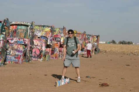
C. Texas: exit 60. Park at Loves. Cadillac Ranch. A long walk (1/4 mile, give or take) or a short bike ride. Bring your spray-cans so you can pay proper homage to this Texan Stonehenge. (In case you’re not a pop-art snob, the work consists of several Cadillacs buried up to their windshields in the middle of a cornfield.) I recommend this highly (no, not that high) for the fantastic photo opportunity alone. The cars are very colorful, fun to vandalize, and will put a stupid grin on your face.
Me 'n Art. Cadillac Ranch, Texas.
D. Tennessee: exit 447. Park at the “Downtown Hartford Citgo.” (“Downtown” Hartford consists of two gas stations, a restaurant, and a couple of seasonal rafting outfitters. The off-ramp nearly runs through The Downtown Hartford Citgo.) Due to a flat tire I’m writing up a restaurant. An espresso shop/hamburger joint. Whatever works. But, it has a nice deck with a view of the Pigeon River, occasional wildlife, and raft-loads of bright orange tourists. The majority of folks opt for rafting, which does save time and money (2 hours, about 40 bucks versus 4-5 hours and 150 bucks for kayaking). Hartford sits on the Pigeon River, surrounded by the Cherokee National Forest, and a stones-throw from the Great Smokey Mountain National Park and Appalachian Trail. The plan was to find the Appalachian trail, but fate decided a flat tire midway there would be funny. Plan B was kayaking, but fate talked me into calling an hour too late, “would you like to make a reservation for tomorrow?” Uh, no. So, I sulked at the River’s Edge Café (I think that’s what their sign reads). Pleasant little oasis from the trucking community. So, from the “downtown” truck stop head under the freeway and the café is at the “T,” a block & a half maybe.UPDATE: ACROSS THE STREET FROM THE TRUCK STOP IS THE ROAD TO THE MOUNTAIN BIKE TRAIL! Duh. Third time’s a charm. I guess locals drive to the top, but only about a mile up Mill creek road is the state forest and trail. Not very
strenuous to get to either. The trail cuts across a few streams where stones strategically break the surface. Tree debris carpets the trail for a nice muffled effect. Very cool trail. Very accessible.
strenuous to get to either. The trail cuts across a few streams where stones strategically break the surface. Tree debris carpets the trail for a nice muffled effect. Very cool trail. Very accessible.
I-44
MB. Oklahoma: exit 222A. Park at QuickTrip (QT). Turkey Mountain in Tulsa. 15+ miles of single track. The rocks in this park have character. Some rocks, the sandstones, mimic paved roads with their smooth surfaces. Other sandstones mimic paved roads in downtown Boston (at least the chewed up craters we fought through.) Gigantic rectangular slabs of granite are strewn about other sections of the park. And the ride through is a kick. The ride to get there is not. There is no shoulder on several stretches. Be careful and alert. Head east out of the QT parking lot on 61st for about 2 ½ miles until you get to the water tower on the hill, the park is across the street. Again, be careful; there are blind curves that the driving public refuses to fully comprehend.
I-55
B, C. Illinois: exit 248. Park at Pilot. Turn left out of lot, and bike path starts
just after overpass. Keep on path until you hit the I&M Towpath Trail (Illinois & Michigan canal trail).
Nice flat trail along the canal. The I&M canal was a huge deal in it’s time. It linked Lake Michigan to the Illinois
River to the Mississippi River to the Gulf of Mexico. Just hitch your barge to a couple of horses and away you went.
I-65
B, H, C. Kentucky: exit 48. Park at the Shell truck stop. Mammoth Cave National Park. Head up the road and the trail is off to the right (about a mile from the Shell station, less maybe). The trail is packed gravel, with a few hills so steep yellow downgrade signs are posted warning that you must dismount. (It wasn’t photo-enforced so I risked it, and lived. But, be careful – there are no runaway bike ramps.) The visitor center & main cave entrance is nine miles in and from there you can purchase tour tickets. I took the short, free tour. The tour guides are Park Rangers so they’ll try their damndest to teach you something – be careful.
Daylight! Mamoth Cave National Parks, Kentucky.
I-70
MB, D. Colorado: exit 19 (or, much better, exit 15 & park on the on-ramp just after you cross the scales). Kokopelli’s Trail is a 142 mile trek starting from just behind the west bound weigh station to Slick Rock trail in Moab, Utah (see below: US 191 Moab, Utah). Kokopelli is the magical being whose flute playing lures bicyclists over breath-taking cliffs, and into the Colorado River. Or, the party line is he’s a magical being associated with the Hopi Indians, and “recognized by many Native American groups of the Colorado Plateau.” At any rate, the area is magical. The trails weave among the spectacular red rocks, and atop cliffs overlooking the Colorado River. You’ll wear out your finger taking pictures. Oh, in case you need bike work done there are a couple of bike shops in downtown Fruita (on aspen, a block north of I-70). I needed emergency repairs, took it to Single Tracks Bike Shopand the owner fixed me up while I waited! Grab some maps while you're there, they're pretty handy to have. Minor UPDATE: Ask our good buddies in the weigh station if you can park there; they’ll
probably say yes. That's how they answered me.
Kokopelli's Trail, Colorado
B, MB, D? Colorado: exit 114. Park at the Tomahawk truck stop, or at one of the nearby rest areas. Lots to do here. The Shell truck stop is petite, but luckily Glenwood Canyon & Glenwood Springs are easily accessible from the rest areas. Scout Trail is hundreds of years old, established by hot springs bound Ute Indians. Ride through town and follow the signs to find the trailhead, which is at the end of 8th avenue. For a more gentle ride, the trail along the Colorado river passes through the handful of rest areas along canyon. Odds are pretty high that there are some fine dining choices here as well.
X, H. Colorado: exit 196? Gore Range National Forest trailhead. Can’t get much closer than this place. Don’t go very far though: sight of the ski lifts you may zap your momentum.
B, MB, D. Colorado: exit 266. Denver Downtown, Dakota Ridge & Red Rocks Mountain Biking Tails (yes, same Red Rocks as the amphitheater). Park at TA (Wheat Ridge). Bus stop across the street will take you downtown – malls, dining, etc. According to Google it’s 8.5 miles from TA to Dakota Ridge Trail. What you want to aim for is Zorro Trail which connects to Dakota Ridge and can be seen from the highway. Best to take a smart phone and do some googling. Golden, believe it or not, is a beer town and just a nice little bike ride away via Clear Creek Trail. Head west on W. 44th, left on Youngfield and immediately before RV Four Seasons (1/2 mile max) is the trailhead. Near Golden is Chimney Gulch Trail that looks like it takes you to Apex Park – but those are still on my to do list.
Dakota Ridge Trail. Denver (more or less), Colorado.
B. Colorado: exit 278. Sand Creek Greenway (Denver area). Park at TA, or Sapp Brothers. From TA: Right (south) out of parking lot onto Quebec street, over overpass, cross onto pedestrian bridge and path is off to the side. Gentle, packed gravel trail with some access to stretches of single-track along the creek. Spring seems to be the perfect season for frightening the rabbits and boring the prairie dogs; at least those were the reactions I garnered. UPDATE: Bike trails are everywhere throughout the Denver area (as you have probably noticed yourself). Flying J in Aurora (exit 285) is a few blocks from a trail. Dodging traffic is much less of an issue at Flying J than at TA. Head south on airport boulevard and if you reach the stoplight you went too far. FINAL UPDATE (until the next one): Safest, sanest, most convenient parking is at Sapp Brothers. The Sand Creek Greenway is on the other side of Sapp’s fence, northeast corner. Follow the path north, turn left (west) at the T, and ride the South Platte River Greenway west to get to Denver.
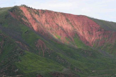
Red Mountain
Glenwood Springs, Colorado
B. Kansas: exit 298. Park at Shell truck stop, Junction City. The bike path is just inside Fort Riley boundary, but before the main gate (in other words, public area - no special pass required). Go north on East street, west on 6th street, north on Washington street. Trailhead/parking area is on the left. Downtown, take a moment to pay tribute to our soldiers in the memorial park.
B. Missouri: exit 101.Park at Loves. Katy Trail State Park. Head west down the frontage road to the end, up the gravel road past the trailers, and cut across the cornfield onto the trail. (I asked permission, but only for myself, so be sure to do the same if you encounter the landowners. Undoubtedly, there is a better, more official entrance, probably closer to Boonville, but I haven’t been back for awhile.) The Katy Trail is 225 miles long and runs from St. Charles to Clinton, or a majority of the state’s width. It is hard packed gravel, kind of sandy, but not bad. Nice rural farm scenery.
B, C. Illinois:exit 4a. Park at Pilot. Saint Louis and it’s big stainless steel French fry are just across the mighty Mississippi. Bounce down the cobblestones, past the gaggle of tourist restaurants, and over by the old power plant is a bike path. (To be continued…)
I-75
MB. Ohio: exit 164. Park at Pilot. Van Buren State Park. The park is one mile east of Pilot, follow the signs. Nice trail that winds nicely through the trees. Watch out for horses and their burdens; they have the right of way, and many get spooked by bicycles. Some of the trails near the bottom get muddy. Turn around before the mosquitoes know you’re there. Whatever you do, don’t lose your momentum, step off the pedal, and let the mud suck your shoe clean off your foot; somehow these actions alert mosquitoes to your presence.
B. Kentucky: exit 120. Iron Pike Legacy Trail. Currently about 12 miles long. Small truck stop a block west of freeway, a block east is accessible by bike on Northside and it crosses road a little further near trailhead parking. Northside goes about a mile up along freeway, from trailhead it meanders south where it meets New Town Pike (2 miles south of a McDonald's with truck parking) and continues after a little bit of roadside. It can be busy with joggers wearing headsets, so slow down to pass. Contributed by Jay Rowse.
B. Kentucky: exit 175. Park at Pilot (either), or TA. Who could pass up a place named, “Big Bone Lick State Park.” Turns out I’m in good company: William Clark (sans Lewis) is credited with birthing American paleontology there. Mr. Clark applied his scientific methods to wooly mammoth bones discovered at Big Bone Lick. The park is six miles from the truck stops, up and down rolling two lane roads. Pastoral stuff. Many pastorals. (Kentuckians love their grass, maybe more so than Californians.) I’m not much for road rides, but the horse farms, birds (cardinals, blue-colored birds, yellow-colored birds – I’m a bird buff), a couple of deer sightings, few historical markers and perfectly balanced hills kept me thoroughly entertained. Go west on Richwood road (aka, KY 338) and follow KY 338 signs until you get to the park.
Richwood, Kentucky
I-76/81
MB.Pennsylvania: I-76 exit 226; I-81 exit 52A (northbound), exit 52 (southbound). (Messy. I thought this part of the country was settled by Germans.) Park at Flying J. Appalachian Trail. Head east on US-11. The path to the trail is on the left (north) side of road just before the pedestrian overpass. It’s not much of an entrance, and it’s very easy to miss.
Carlisle, Pennsylvania
Appalachian Trail
I-77
MB, B. Ohio: exit 145. Park at Pilot. Cuyahoga National Park is just around the corner. Cuyahoga Valley is pleasant, even pretty, but with no plunging canyon walls, or dramatically sculpted buttes it definitely gained entrance into the national park system based on the talent portion of the competition. And that talent was politics. It gained national park status by riding the“urban parks” wave of the seventies. Don’t get me wrong: if I can’t get near Slickrock, I’ll gladly ride Cuyahoga.
Rain kept me locked in the truck preventing a full fledged exploration, but I still managed to go up and down some nice paths, and found the Buckeye Trail, which is amenable to mountain biking (grudgingly: doesn’t promote, but doesn’t
restrict). The Buckeye Trail meanders through many of the outer counties in Ohio. Cuyahoga’s featured path, and main attraction, is the Ohio and Erie Canal Towpath Trail. I’m sure you’ve heard about them in your history classes. So, to
get there head north out of the parking lot on Brecksville and ride 1.6 miles to Valley Parkway. And you’re there. Buckeye Trail entrance is about a third of the way down on the left. Or, alternately head north on Brecksville and right on
Snowville and it leads to park headquarters (didn’t go, myself). Towpath Trail is down the length of Valley Parkway and across the river (which, navigating by memory and instinct, I missed completely).
I-80
MB, H. California: exit 26. Go east on Cummings Skyway (connects to highway 4) and park on the big dirt pullout on the left. Entrance to Crockett Hills Regional Park is just across the lot. I must confess, in full-on, unadulterated disclosure that I only hiked the trail (we parked there overnight and didn’t suspect that we were sitting on top of a trailhead. Also didn’t feel like showering from a jug in broad daylight). We (frau und moi) hiked about then jumped into the bushes a few times to accommodate mountain bikers. Nice view of the bay, and apparently the trail connects to a larger system that circumnavigates the bay. Groovy! (But better find a more secure location for an excursion of that magnitude.)
B, C. California: exit 81. Park at Valero (West Sacramento). California State Capital, etc., etc… And you thought that trucking would never allow you the opportunity to take your florescent pink, skin-tight, Lycra® Tour d’ France riding outfit out of the closet. Wrong! Sacramento is the fancy-pants (and shirt) capital of the bicycling nation. In fact, Sacramentans (Sacramented? Nah, that’s not nice) seem pretty comfortable in their own skin (tights). Just remember to keep right; they are fierce peddlers. For film buffs the state capital is just a few blocks further east. The Terminator was filmed there, or something like that. I don’t have any fine dining recommendations other than to follow a politician (which might lead you to a whorehouse, which might inadvertently expose the congressman, which most likely would sully the reputation of the whorehouse, so nix that suggestion). Anyway, to get there: Head East, save my life I’m going down for the last time…Dum, de Dum, Dum, woman with a sweet love’s better than a white line…wooaaaaaaaaaaah!!! So, like I was saying, go east on West Capital Avenue. Cross the bridge and the bike path follows the river; or, go straight (ha, no pun inferred) to get to the capital.
H, X. California: exit 174 rest area (or close to it – Donner Pass Summit in any case). Pacific Crest Trail at Donner Pass. A spectacular place to work up an appetite. Seriously though, this is not the place to tell your beloved that they look good enough to eat. On the eastbound side take the ½ mile Glacier Peak Loop which will connect you with the Pacific Crest Trail. Westbound, the Pacific Crest Trail is behind the rest area building. Today I was surprised to learn that the rest area was open (after a number of days of heavy snow). I passed it last year during a storm and it was closed. But today was sunny, clear as a bell. So, I threw on my snow gear and expended the energy I saved from not chaining up. This is a spectacular time of the year to tromp around. It would have been even better to be one of the cross-country skiers that passed me. Someday I will stow some skis on the truck. UPDATE: X-Skied a couple of times. Beautiful, but....does CALDOT have the rest area open? Are they about to make you chain? Is it about to snow? UP*F-ING*DATE: Hole in the Ground. So close all these years! Some sweet elevation gain, including albeit, finding the damn trail (off of the fireroad, but what’s new). HoleitG is not a part of PCT, but it comes awfully damn close to it. In fact, if you’re on PCT, you are not on HitG. Like I said, elevation is at close to cargo level (eight thousandish). Roundtripish (THAT passed spellcheck!??) it’s about 16 miles back to I-80, but that’s according to MTB project because due to work constraints I bailed out when it started getting interesting, ie, the rocks.
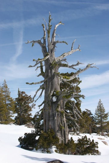
An evergreen, sort of. Donner Pass, California.
B, MB, D, C. Nevada: exit 20. Park at Petro. Truckee River Bike Path. Head back to the light (intersection of Sparks blvd and E. Greg st.) and the trail starts in the field behind the light. (From TA go south on McCarren and the trail is along the river. Look for the guardrail and steer to the right of it.) The path follows the Truckee river and winds up downtown by the National Automobile Museum and the famous “Reno” sign. I think the path probably picks back up again somewhere around there, but I have not explored further. UPDATE: The trail indeed picks back up across the street on the other side of the river. It looks like a pedestrian mall, and it is, but it’s also the approved bike path. Pick your way through the walkers and gawkers until you get to keystone avenue. Keystone takes you straight to the Keystone Canyon trailhead (keystone avenue, once it crosses McCarren, and gets within spitting distance of Keystone Canyon becomes Leadership Parkway – that should get you fired up for your ride). Nice ride, with a few leg-burning offshoots.
You could easily stumble upon fine dining with all the casinos downtown. Wild River Grille though, offers daylight and is a nice alternative to casino dining. Mary Tebbs opened up her pipes and played her guitar for us. And did it well. I’m pretty sure there are others lined up on summer weekends.
UPDATED UPDATE: Zipper Loop. 4.7 miles from TA. Further investigation in order, please stand by ….
MB, B, D. Nevada: exit 176. Winnemucca and Proud of It. Pleasant surprise. Doubly nice that the trailhead to Bloody Shins is on the edge of town. Hat trick that the wind was strongly at my back for the slight uphill ride. I knee-jerked onto the single-track hoping neon trail markers would materialize to guide me toward unsafe choices. Alas, no neon, no blood. (Sounds like a pandering political chant.) Apropos of nothing, the dust reminded me of the talcum powder like consistency of Eastern Washington volcanic ash circa early ‘80s. (What the hell’s that got to do with anything? Told you, nothing.) Anyway another expedition is required to Bloody up my Shins.
MB. Nevada: exit 351. Welcoming committees generally don’t greet you via CB radio. And I suppose, technically, the brothels doing the welcoming aren’t officially designated representatives of Wells Nevada. Rhode Island and Nevada both have legalized prostitution; the former abashedly, the latter unabashedly. (The stuff you learn on talk radio.) Anyway, cheaper thrills can be had taking a bike ride on Bureau of Land Management Land. Follow the I-80 business loop through town. Follow Angel Lake road up the first big hill and BLM land begins after the houses. This isn’t what I’d call a biking destination, but the thrills are there if you work a little at it.
MB. Utah: exit 122B (FJ), or 118 (Pilot). Flying J. Bonneville Shoreline Trail. UPDATE: Well, looks like I never got around to writing this up in the first place. The good news (religious pun not initially intended) is you’ll get a good amount of sightseeing in before you reach the trailhead; the state capital, the Mormon capital, Temple Square, assorted LDS buildings, sculptures, parks, etc. Most unique sight of all: large gatherings of men in three piece suits waiting for the bus. So, to get there: out of loves turn east onto North Temple and head for the hills (the giant “U” on the side of the hill to be exact). North Temple turns into 2nd, (but construction forces you to detour a few blocks south, then east thru the Gateway mall arch, north thru mall, and work your way back onto 2nd). Take 2nd then north on Virginia (or cut thru the cemetery onto 11th) then east on Popperton Park Way until you reach the bike path. Bonneville Shoreline Trail is to the left when the dirt road splits.
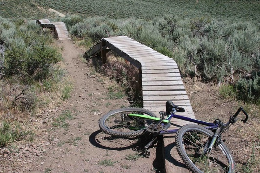
MB. Utah: exit 146 park at Bell’s Silver Creek Junction (Sinclair). Park City proper is less than 10 miles from the truck stop, but much closer (about 2 miles) is the Round Valley Trail system, described by other websites as a nice warm-up for the world renowned destination trails. I suppose so, if you’re a sexually frustrated teenager, or vacationing there for the week. And on that day, I was neither. What I’m trying to say is that Round Valley is a great ride and a good workout. They also have some nice playground toys to ride on. Warning signs note, however, that failure to use proper skills could result in disfiguration, inability to procreate, embarrassment, and splinters. No pain, no maim. So, to get there: head south on US 40 (wide enough shoulder, but there is a merging onramp that requires your extreme attention) take the first exit and follow Silver Summit Parkway until you see the trailhead, about 2 ¼ miles. To get to Park City, take a right there on Trailside Drive and follow that to Old Ranch Road. Follow Old Ranch to State Route 224 and on to Park City (or take short cut bike path which ends up on 224 also).
Best left to the kids. Round Valley Trail, Park City, Utah.
B. Wyoming: exit 6. Park at Pilot. Bear River State Park. Paved and gravel bike paths. Some mountain biking exists if you head south towards the river. The bushes are a bit thick, but if you wear your helmet and keep your head down the disfiguring scratches should be minimal.
B, H. Wyoming: exit 310. Park at Pilot, or Petro. Across the street from Pilot to the east is the Laramie River Greenway.
Laramie River Greenway, Wyoming
MB, X. Wyoming: exit 323. Park at the rest area. Pole Mountain, Medicine Bow National Forest. Stopping here violates my most ironclad rule: don’t tempt fate – get out of Wyoming while I still can. However, blizzard activity falls way off in the summer. But, what about the wind!!? Pay no attention to the wind; once you get into the trees it goes away for the most part. Anywho, this is one of my favorites with several trails and a nice mixture of ups & downs. Go east (right) out of the parking lot and the trailhead is just over the hill. Update: About tempting fate: instead of fighting the snow, ski on it (well, x-country anyway). Plenty to explore.
H. Wyoming: exit 401? Park at the rest area. Pine Bluffs. Nice hiking paths and trails. One leads around the bluff to the University of Wyoming archeological museum/dig (only open during summer, though; haven't been yet).
H. Nebraska: exit 52+/- eastbound rest area. A good place to stretch your legs, or perhaps fit in some cardio should you come across the advertised rattlesnakes. There is a paved path to the west of the restrooms, and a dirt trail to the east. From the top you can get a good view of, Nebraska (in case you forgot what it looked like).
B, D. Iowa: exit 1b. Park at the truck stop of your choice. Iowa Riverfront Trail. Go south over the freeway and into the park. The trail starts behind the info center, winds along the casinos and connects to an artsy-fartsy foot bridge across the Missouri river into Nebraska. There you can continue on the Omaha Riverfront Trail (but I haven’t yet). Back on the Iowa side, we saw kids hauling bagfuls of morel mushrooms from the riverbanks. That’s the fine dining entry. But, I kind of doubt the kids go home and gorge on their mushrooms as if they were Halloween treats. So, there must be restaurants around that the kids sell to.
B, H. Iowa: exit 125. Park at Love’s (at least that’s what I think it is today). Greater Des Moines Recreational Trails. This is one of the most accessible trails to get to from your truck; just scale the cyclone fence, drop, and roll right onto the trail. Or, I suppose you could take the service road (between Loves and Menards). Rip your clothes on the fence going over and nobody will tease you about being a birdwatcher. Then again, there is the graceful option I mentioned. So, birdwatcher are ya? (I’m having a hard time admitting it myself.) Birds flock to this place. It was a gray day, so grey slabs of ice acted on a conspiracy to flood the creek. As I watched, a few crucial pieces weaved their way into the growing ice dam. With all the black & white and shades of grey (man, I don’t want to offend, who’s turn: “gray,” or “grey?”) blue birds, blue jays, cardinals, red squirrels, and several other eye-poppers screwed with me. Royally. I’d hit the brakes, pull out the camera, focus…and they’d be just a few branches out of range. Not even Photoshoppable. All the pretty colors set against the gray. Ah, well. As Dad says, “at least you saw it.” See for yourself.
B. Iowa: exit 292. Park at Flying J. Duck Creek Trail. Coming and going, Iowa has a bike path for you (see above entry). Duck creek trail is a gem that meanders through suburbs and parks thereby skirting most city noises, especially traffic. The place is idyllic and wholesome: high school seniors fold their arms and lean against trees, grandmothers ring their bicycle bells, and no-nonsense squirrels forage. You kind of expect to see Normal Rockwell set up on the lawn. Ask a local how to get to US-67 from the trail if you care to get to the Mississippi. There is a waterfront trail into Davenport starting roughly at US-67 & I-74 (under, of course. Also, there appears to be truck parking at the casino). From Flying J go south on Northwest boulevard, and south on division until Duck Creek Trail, about 3.5 miles all told. To the Mississippi from Duck Creek is about 10 miles (one way); as the crow flies, a little over 6 miles (one way).
B. Ohio: exit 145. Park at Pilot. Cuyahoga National Park. See I-77, exit 145 for description.
B. New Jersey: exit 4. Park at the TA. This is a gorgeous, pastoral area with historical register type houses and farms set amongst the wooded countryside complete with babbling brook. Deer love the place; I frightened a couple different groups while riding. My initial goal was to find and ride the nearby Appalachian Trail. A resident of one of the historical register type houses who was loading a kayak onto his historical register type Volvo station wagon told me that the trail was just behind his house. The catch was that it was virtually impenetrable, especially by bicycle. Even so, he occasionally redirects wayward hikers that stumble through the brush and onto his property. He supposed that once I was up on top of the Appalachian Trail I probably could ride my bike, but he added that even at the proper trailhead entrance the hike up is pretty strenuous. I would have loved to go back and hike the area; unfortunately, the area was put off-limits to us a few days after my visit. If it is not off-limits to you (and your rig is secure) here are the streets I took: exit west out of TA onto Simpson road, right onto Hainesburg River road, left onto Hemlock road, right onto Mt. Pleasant road, right onto Route 94. Across the bridge there is a rails-to-trails trail, or take Route 94 back to TA. Also, you can cross the Delaware (bring a portrait-painter) on the pedestrian bridge and visit Pennsylvania. (I forget the streets, but I remember it being pretty easy to find – go out the front of TA.)
I-82
B. Washington. Exit 36. Park at the Gearjammer. Yakima Greenway. Not many truck stops are this close, within walking distance, to shopping and restaurants. But what’s a nice restaurant if your hair isn’t sweaty and plastered to your head? So, go out the Gearjammer the way you came in, go under the freeway and the Yakima Greenway is straight ahead. It’s paved, follows the river and is pretty flat. In the summer months volunteers patrol the path dispensing cold drinking water. Delicious. By the time you get back you should be ready to plop into a naugahyde booth, bath in the air conditioning, and order some food.
MB (If you have access to a car, taxi, or if you have too much time & Energy to get there. It is 9.6 +/- miles from the Gearjammer, mostly uphill.): Cowiche Canyon Conservancy is an excellently designed single-track trail that twists in and around the sagebrush with just enough hills for a workout going up and to get your adrenaline pumping going down. Optionally you can take the trail down into the canyon itself: this is more spectacular visually, but the trail descends mostly down. So, if you really want to ride there go west through the mall parking area onto first street. Head north into downtown and take a left on Yakima ave. Take a right on Summitview and ride until 74th ave. Take a right, then a left at the stop (Englewood). Follow Englewood until Scenic and turn left across the double yellow and continue on until the Conservancy. See video below.
D. Washington. exit 80. Park at the Shell (Horse Heaven Hills Travel Plaza). Across street to the west is an excellent café/restaurant with a forgettable name. Maybe I’ll remember to jot it down next time. Family run, a lot of stuff made from scratch. UPDATE: Changed business.
Cowiche Canyon Conservancy. Yakima, Washington.
MMMMMBMMBBMaoekrgt M
MB
MB
I-84
MB, B, H. Oregon. Exit 97 eastbound, 104 westbound. Park at Pilot (4.7 miles east) or on the shoulder by the park. Deschutes River Recreation Area. Can’t much closer than this. I’m stoked about this discovery. My big horn sheep photos come from just around the bend, and park wildlife signage depict enormously horned sheep. The trail was breathtaking (the
clouds of gnats were thicker and more pervasive than the drizzle that day, so I had to keep my mouth shut). Anyway, once I got off the gravel trail and onto the single track the gnats mercifully disappeared. The path is not especially challenging, but it is a nice ride with great scenery, and there is that potential for wildlife.
MB. Oregon. Exit 188 Park at Pilot. I stole this (and a few others) from Singletracks.com, an indispensible resource for finding mountain-biking trails throughout the US. Otherwise, I never would have guessed that Echo, Oregon is home to one of the more enjoyable trails around. This incredible trail features sagebrush as if they were thoughtfully placed gates in an Olympic slalom event. It’s fast, fun, curvy and gives you an appreciation for the northwest desert that you might otherwise be hard-pressed to acknowledge. So, head west (right) out of the parking lot towards Echo. Turn right onto Main street and go through downtown Echo, over the Umatilla River, two irrigation ditches, and up a very slight hill. Then turn left onto Snow road (gravel) and take another left when you get to the windmill. Follow road to the bottom of the hill. Trail obvious on the right. Suggestion: stay upwind of the gravel trucks – a few of the drivers are rednecks and courtesy (not to mention safety) are not considerations. Thanks to most of the truckers who were courteous/safety-conscious.
B. Oregon: exit 216. Deadman Pass (Pre Cabbage Pass, aka Cayuse Road).
X, H. Oregon. Exit 230? Park at the rest area. Behind the northbound Deadman’s Pass rest area is a dirt service road that climbs up the hill to the cell towers. The road also continues straight, but that takes you onto restricted Umatilla Reservation land. So, go up. Take a camera just in case: I saw a few deer, and many of their friends’ tracks in the snow. The maintenance guy at the rest area says he recently saw the paw-print of a black bear. Anyway, the area is pretty, and the snow is often fresh. But, best of all you can ski down coming back (as opposed to the usual glorified walking of cross-country).
B, MB, D? Idaho. Exit 52. Park at TA, or Flying J. Eagle Ridge Trails, Boise. Go about three miles from the TA on US-26 (Broadway), past Bronco Stadium (with world’s only Smurf Turf), and just past the hospital turn right onto reserve street. (Broadway changes into N. Ave B, and something else, but for only a few blocks and then bingo-bango there’s reserve street.) Or, if you feel more inclined to stay on pavement, there is a nice-looking bike path along the river just after the stadium. Be awfully careful as you start down US-26 because there are a pair of high-speed merge lanes, one each direction. Then, like a referee that has blown a call, the city planners get heavy-handed with the stoplights. Very minor annoyance. Anyway, once on Eagle Ridge trail, breath in through your nose, and out through your mouth. This isn’t exercise advice; the place is redolent with wild roses, especially along the creek. (Beats the hell out of pungent ragweed.) Looks like there are some fine dining options going back, and surely some downtown (Boise is the state capital so there’s got to be a Pork Barrel® nearby).
UPDATE: Across the street from Flying J is a nice, sane (see above regarding US-26) bike path to downtown. I got a little disoriented trying to get to Eagle Ridge, but there’s only so much of Boise to get lost in. (A good thing, in my book.) MINOR UPDATE: Across the other street there is a strip mall, to include a grocery store, bank, ect. Very handy, very accessible.
B, C. Idaho. Exit 173. Park at Flying J. Twin Falls & Shoshone Falls. Gorgeous gorge, George. I keep wondering about places like this, how the horses knew not to fall to their deaths. Or how the buffalo allowed themselves to be herded over the edge in places like Madison Buffalo Jump State Park, Montana, and (even better) Head-Smashed-In Buffalo Jump, Alberta, Canada. Which brings me to the bungee-jumpers. Didn’t see ‘em. Crowds gathered to watch, but the impending sunset imposed a deadline on my ride. Instead I took an obligatory trip to the falls. Nice little ride. Head towards town on US-93, go across bridge, into visitor info parking lot, then go under bridge. The path parallels the rim of the gorge. Just as you settle in for a nice pleasant ride, someone obscenely plops a McMansion in the way. McBastards. Anyway, the easement takes you to Eastland where you take a left, and then left at the light onto Falls street. From there follow the signs. The park is down about three-quarters the depth of the gorge. Roundtrip it’s about 13 miles. If you need a workout, take the Canyon Rim trail. Very nice views. However, it dead-ends at the top (they got a theme going) and if you try to cut across the adjacent field the cops will gun you down. Really, it’s their firing range. MINOR CORRECTION: Probably not bungee-jumpers, but rather base jumpers (parachuters). Perrine bridge is one of the few places where it is legal to base jump.
Shoshone Falls, Idaho
B, MB. New York: exit 6. Park at Pilot. Storm King Mountain.
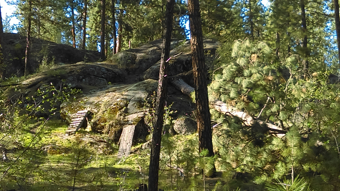 I Defied Death (by going around). Sekani Park, Spokane, Washington.
I-90
B, H. Washington: exit 34. Park at the TA. Snoqualmie Valley Trail. Go west out of the parking lot and follow the road about a mile and look for a sign (kind of wet over there, so it won’t be a burning bush) on the right, “Snoqualmie Valley Trail.” Continue west for a nice flat ride in the shadow of Twin Peaks, (aka Mount Si). Veer off the path to hike Mount Si, purportedly the most hiked destination in Washington. Or, veer off into North Bend for eats, shopping, etc. Or, instead of following the path west, cross the street at the sign and ride east. This option offers single track excursions.
H. Washington: exit 47. Granite Mountain Lakes? (Should have written it down while it was fresh Karl!) Park on the shoulder and tromp through the grass to the left and onto the road. Follow west until you hit the trailhead. Nice little hobbit-like trail through the forest. It is a deceptively quick climb in elevation which rapidly becomes apparent through copious amounts of perspiration. I only did an hour’s worth roundtrip, so I didn’t go the distance and see what attractions might have lain in wait.
B, H. Washington: exit 54. Park in the immediate dirt lot. Pacific Crest Trail. Follow the dirt road back to the trailhead for the gentler hike, or go down under the freeway and up the road to the other trailhead for a more rigorous hike. I did the latter. There is a lake to aim for with the former, and the later is more forested. The Forest Service ladies said there isn’t really any single-track to speak of, but there are logging roads and the paved roads offer plenty of scenery. They had a story about a spectacular mud slide that took out a chair-lift and a house(s?).
B. Washington: exits 106 & 109. Manashtash Ridge. Park at Pilot, or Flying J (look to be the same distance). From Pilot exit lot as if returning to I-90 eastbound. Turn left on Thorp Highway, left on Hansen, and left on Cove until the trailhead. (5.2 miles Pilot to trailhead). Sandbag it there – pace yourself: it’s over 2 masochistic miles straight up, all but the very beginning and last 100 yards or so virtually too steep to pedal. It’s more like mountain climbing, but with a bike instead of pitons. Pull out a notebook from the green ammo can
and write something witty (like “SEMITOURIST.COM was here”) before going back down the way you came. On the way up you’ll probably be tempted to take the path off to the right amongst the big pines, but by then you’d almost be to the top. Anyway, that’s the downhill trail – backtrack to there after reaching the summit.
B, MB D, C. Washington: exit 286. Park at Flying J. Spokane, Washington home of Bloomsday one of the biggest foot races in the country (world for that matter) & Hoopfest, THE biggest 3 on 3 tournament in the world. Factoids, schmactoids. Do see the Spokane Falls in the spring if you can - lots of water moving quickly, powerfully. Dam! Unfortunately, yes. (I am a fan of energy, but am aware that fish need to be killed, air browned, or tortoises baked to get a charge out of life. Still, an unleashed Columbia would be one of the world's greatest wonders.) Anywhoo, the Centennial Trail connects Spokane & Courer d' Alene and roughly follows the Spokane River. Heading from the Flying J to Spokane, Sekani Mountain Bike Park is on the north side of the street. It packs the potential to split your noggin widely apart, so pick your trails accordingly. That said, whee!
B. Idaho: exit 7 (weigh station). Face it: the DOT will get their jollies at your expense. Whatever. Jump on the Centennial Trail and ride into Couer d’ Alene, or go the other way and head towards Spokane. Whichever way you go you can be comforted that the DOT folks are still in their shack staring at trucks going by at 3 miles per hour (if you still think of them at all). Couer d’ Alene has a few fine dining options, and Spokane more so.
B. Montana: exit 220 (technically I-15,exit 122). Sections of Butte, Montana are super fun. These areas are designated by signs that read: “Super fun site: Keep out.” Sorry. Seriously though, I did have a wonderful time riding around Butte. Copper mines rule the town with their black derricks braced against the wind like Eiffel towers with a purpose. These derricks also serve as memorials to dead miners. On the east side of town is the enormous open pit mine. Colorful. I intend to catch it at sunset someday.
After riding up and down Butte, dodging traffic (if you can find any) stop in at Montana’s Bean N’ Cream for the cheapest (great) coffee around ($1.00 12 oz Americano). They also boast about their breakfast burrito (which I suspect is a bargain as well).
MB. Montana: exit 455. Park at the Pilot. The Zimmerman Trail is awesome, once you get there. Unfortunately, the ride there is just under ten miles, uphill. Not terribly strenuous, but time consuming. It took me an hour, nonstop. But, once there, wow! The monolithic slick-rock cliffs were once an irresistible draw to car-disposal enthusiasts. A few automotive skeletons adorn the cliff faces. (Factoid: garbage > 50 years old = artifact; garbage < 50 years old = garbage. Thoughtful consideration seems obvious if you plan to gift your garbage to the next generation – otherwise some inconsiderate slob might just pick up after you! And legally, too!) These days the slick-rock cliffs attract mountain-bikers, hikers, and lovers (make plenty of noise as you approach the latter). So, head west out of the Pilot parking lot on the frontage road, connect with the I-90 business loop (US-87) until the next stoplight, turn right, north on US-312 to 6th avenue bypass (half-way up the hill on the left), and another left on airport road (state route 3) – or, take the pedestrian/bike path just before airport road (longer, but no traffic for awhile). OR, if you have some miraculous, legitimate reason to be driving on state route 3, there is lots of parking available off the side of the road near the airport. Otherwise, keep pedaling past the airport until you pass the airport entirely and reach the next stoplight for Zimmerman Trail Road. The parking lot is on the left just past the stoplight.
I-94
H. North Dakota: exit 36. Painted Canyon, Theodore Roosevelt National Park. This is where Teddy got his inspiration: “Taxidermy, by God! Kids will eat it up! Bully, bully!!” That’s the unofficial version. The official story is that he went out hunting bison, got blanked, it rained, and when it stopped he cunningly followed the muddy hove-prints until…”Ha! Gotcha, you crafty beast!” Anyway, there are plenty of bison around now (nudge one aside and park – seriously, once I saw three strolling across the parking lot). There is a nice little trail that loops around and back. Some of the trails that branch off are bison trails and the ranger told me that you can get quite lost following one. So, don’t follow the bison trails. And don’t think of shooting one and becoming president - that’s illegal in a national park.
B. Wisconsin: exit 4. Park at the TA. Willow River State Park is a few miles down the road. The road winds down to a nice little lake and a nice little dam. Nice little white tail deer populate the woods. Refreshing to see upright deer in Wisconsin.
B. Wisconsin: exit 55. Park at the BP. Omaha Trail. You’re suppose to get a permit from one of the stores for a dollar, but there is a slot at the entrance as well (but no permits). Anyway, nice flat trail through farm country. I exited onto a dirt road a few miles in and enjoyed that more. It in turn dumped out onto a paved road with hardly any traffic. Bucolic, pastoral. If only the deer would have cooperated.
B, H. Michigan: exit 30. Park at the Flying J. Lake Michigan, Dunes National Park. Follow these directions explicitly, at least at first. Or, else. If you go as the crow flies they may circle back and peck at your remains. Not quite that bad, but it’s sure a chore to get across town in a straight line (no bike lanes, or sidewalks). It’s quite a lake. It’s great. Riding close to the water, where the sand was wet and packed, I was able to get to St. Joseph. Between the two towns (Benton Harbor being the other) St. Joseph has more to offer. So, the directions. Go west on E. Napier, northwest on Pipestone road, west on W. Main street and then poke around until you find water.
I-95
C. New Jersey: mile marker 17? Vince Lombardi service area, Ridgefield, NJ. New York, NY.
Bus 321 into NY costs $3.75 and driver will even make change for you. Bus 321 at gate 214 back to New Jersey will cost you nothing – but first you have to get thrown off, then find a supervisor, and with your NJ Transit schedule in hand point adamantly at the section that says “driver will make change.” Then when the supervisor says, “That only applies to New Jersey,” laugh self-deprecatingly, and pretend you’re willing to go back downstairs, purchase a ticket, and get in line for the next late bus. Hesitate before stepping away and ask, “when’s the next bus due?” This seals the deal because the supervisor would rather let you board than let you know how late the buses are running. Or, save the drama and purchase a ticket.
Back to our adventure. The New York bound bus arrives on 42nd street, a block away from Times Square. If you made it there, you made it across the Vince Lombardi Service Area and into the adjacent park & ride. It’s that easy; twenty minutes (depending on traffic). Just before diving under the river you’ll get a spectacular view of the city, which if you want to blend in, you’ll ignore. (Bah! Seen it.) Get off the bus, follow the crowds to daylight. Disoriented? Ask a cop. They occupy every corner and seem happy help.
After seeing the bright lights you may want to head to Zuccotti Park and agitate the Occupy folks. Don’t bother, they’re hibernating. Take the subway anyway, let your mind wander a bit, and you’ll be in Brooklyn before you know it. So, I missed my stop and landed on the other side of the river. Serendipitous, ‘cause it’s a damn good place to view the bridge and Manhattan. After you and the complete stranger finish taking pictures of each other, hike back to Manhattan on the Brooklyn Bridge (it has both pedestrian & bicycle paths). Once in Manhattan, plunge forward, or rest and have a beer. I chose the latter. To call it a day, aim for the Port Authority Bus Terminal, gate 214, and
jump on bus 321 back to NJ (it’s all on the schedule).
Manhattan & the Brooklyn Bridge.
B, C. New Jersey: mile marker 30.2, southbound (Walt Whitman service area on the New Jersey Turnpike). Philadelphia, Pennsylvania and Independence National Park. Ask not for whom the road tolls, it tolls until you're completely strapped. Anyway, slip out the back through the employee parking lot and onto the private road (look like you belong there) and viola! you're out into the civilian world. Turn left onto Kresson road, and west on Haddon all the way down to the downtown area. Go under I-676 and take a left and shadow 676 until you get to the toll plaza. The walkway to Ben Franklin bridge is off to the side (cross on the south side). Once across the river the tourist
attractions are self-evident. The actual park is between 5th and 6th.
Philadelphia, Pennsylvania
Independence Hall
Independence Hall
C, D. Massachusetts: exit 44. Park at Best Auto/Truck Stop, Peabody, Massachusetts (paid parking, $10.00/day; maybe able to get away free if not spending night?) Boston. By far the priciest excursion. Because it was our anniversary I cheerfully bent over and grabbed my ankles. Thirty bucks got us a pleasant cab ride from Peabody through winding, pleasant townships (or, maybe they were just well kept neighborhoods) to the train station in Salem (yes, the Salem, a tourist trap itself, as you might have guessed) and back again. Then we walked the streets. The sites are close, but not immediately apparent, so you might want to ask a local (they talk funny on the east coast, but I’ve never had to hire an interpreter). Then, we jumped back on the train to the Museum of Fine Arts. General admission was $23.50, which pencils out to be far less than a penny per brush stroke! Then back on the train to Boston, grab a bite at the food court in Faneuil Hall Market Place (Quincy market), back on the train to Salem, summons a cab to the train station, and back to the truck. I think we were spent, if I remember correctly.
Boston, Massachusetts
Atlantic City Expressway
C. New Jersey: Elwood Travel Plaza. Atlantic City. For $3.55 ($7.10 roundtrip) you can take a bus to Atlantic city to gamble, eat, drink, walk, gawk, or take a man-cab. Or a woman-cab, they have both. Rickshaws in Atlantic City are propelled from the rear. Whether you ride or walk make sure you take in the world-class people-watching available on the boardwalk. There’s also the Atlantic Ocean for your enjoyment. But, other than a few surfers nobody else was in the water – so, I stayed on the boardwalk and kept my clothes on.
C. New Jersey: Elwood Travel Plaza. Atlantic City. For $3.55 ($7.10 roundtrip) you can take a bus to Atlantic city to gamble, eat, drink, walk, gawk, or take a man-cab. Or a woman-cab, they have both. Rickshaws in Atlantic City are propelled from the rear. Whether you ride or walk make sure you take in the world-class people-watching available on the boardwalk. There’s also the Atlantic Ocean for your enjoyment. But, other than a few surfers nobody else was in the water – so, I stayed on the boardwalk and kept my clothes on.
I-295
B, C, D. Park at Hinsdale Oasis. Chicago, Illinois. Slip out the back, Jack and set yourself free. The back being Birch Lane, the employee entrance you’ve probably never noticed (I didn’t until I looked). Follow Birch to Woodland Drive, turn left, then right on 55th and left on either Lawn, or Wolf. This will get you to the train station in Western Springs, about 2 miles. There are bike racks there if you are unable to get your bike onto the train. Chicago, of course, is a Slavic word for city of many Slavic folks. Along Archer Avenue, for instance, there are many “Polski” businesses. So, I figured Chicago was a good place to get a Chicago style Polski sausage. So, I did. It was good.
Getting off the tollways, and out of the truck really enhances the appearance of Chicago; I witnessed a miraculous transformation on my maiden bike ride. Until that point, I don’t think I could have been convinced that Chicago was anything other than ugly. But, Chicago does indeed have some beautiful areas. Life is full of surprises.
Pedaling along Archer avenue my thoughts were interrupted by a young mother shouting, “my money!” And sure enough a bill of undetermined denomination floated up about a story and a half above street level, hitched onto a downwind gust, and instantaneously lurched forward half a block. It took a nosedive, scooted along another half block in the slow lane before coming to a momentary rest in front of the bus stop. I whipped around to take up the chase. I didn’t get close. An elderly immigrant* woman awaiting the bus, rose from her bench, shuffled a few steps into the street, and fixed the bill in place with her cane. None of her movements were hurried, and her graceful performance should have been immortalized on Sports Center. Instead, the young mother was thankful, and I was amazed.
* Our languages didn’t mesh.
Lakefront. Chicago, Illinois.
US-89
B. Utah: Park at rest area. Big Rock Candy Mountain. There are 20 miles of a gorgeous paved biking trail along the river that leads, purportedly, to Butch Cassidy’s boyhood home. (Butch was a pre-television American Idol, for warped reasons maybe, but at least he didn’t sing.)
US-89
B. Utah: Park at rest area. Big Rock Candy Mountain. There are 20 miles of a gorgeous paved biking trail along the river that leads, purportedly, to Butch Cassidy’s boyhood home. (Butch was a pre-television American Idol, for warped reasons maybe, but at least he didn’t sing.)
B, MB. Arizona: Park at big dirt turn-out just over the bridge. Rim Trail is not an internet hoax like I was beginning to suspect. I sampled several mountain biking sites and each one sent me to an opposite corner of the town. Eventually, I asked the kids (everybody’s a kid these days, must be getting on in years) behind the desk at the Page/Lake Powell RV campground and they steered me towards another dubious trailhead. I went up the hill, prospected a few jeep trails, and was about to conclude that the jeep trails were the “mountain bike” trails. But I made one last half-hearted stab and found a bona-fide trailhead, replete with no signage leading up to it. There are mile posts, etc once on the trail, so that was comforting. So, I recommend skipping the sightseeing (except from the bridge, of course) and head up the highway then take the second road on the left (N. Navajo Drive) . The trail bisects the road at the crosswalk – can’t miss.
US 93
MB, D, C, D. Nevada (just north of Arizona border). Park in the parking area across from Hoover Dam Lodge & Casino. Look both ways, like your mother advised, then cross the highway to the sw corner of the HDL&C parking lot, then almost under the heliport is the trail to Hoover Dam. I suppose you could hike it, but biking is light years faster. Bighorn sheep populate the area and I have seen them (when driving). Of course, Lake Mead dominates the landscape to the west. Probably not much that I can add that hasn't already been said about the monumental achievement of the damn. Did have a standoff with a pair of bugs on the way back - really! They charged me, waving menacing antennae.
Had the cheapest breakfast I could find on the menu post-ride and it was still enormous. With coffee, less cheap. Ah well. Gold Strike Hot Springs trail is on the east side somewhere and sounds exhilarating. Bootleg Canyon is about 5 miles from HDL&C. I look forward to updating these latter two excursions. UPDATE: Five gentle, but relentless miles uphill from the Casino is indeed the trailhead to Bootleg Canyon. Bootleg Canyon trails are not so gentle. For instance, on Girl Scout (marked green circle for easy) I failed to negotiate a few rock outcroppings. Had to dismount. Humiliation. BUT! I got ahead of myself. On the journey to the trailhead I noticed a parking area much closer to town. I copblocked the patrol car and asked the officer if I could park all of my eighteen wheels in the lot. He said probably, but better yet why not park on Industrial Road (which is damn near at the trailhead, is easy in/out onto highway 93).
UPDATE: Park at the Railroad Pass Casino/Truck Stop (no, really!) at the beginning of the expansive new Interstate 11, (all two or three miles of it). The truck stop section is so new it doesn’t yet show up on Google (as of August 2018). Look for Earnie’s Trail just after you cross the railroad tracks on the paved bike trail.
US-95
D. Oregon: exit 909 Highway 95 West, Jordan Valley. Rock House Coffee. This is a damn fine place to enjoy a cup of coffee. Their porch is just the place to recuperate from the mind numbing deserts of Nevada and Oregon.
D. Oregon: exit 909 Highway 95 West, Jordan Valley. Rock House Coffee. This is a damn fine place to enjoy a cup of coffee. Their porch is just the place to recuperate from the mind numbing deserts of Nevada and Oregon.
US-97
H. Oregon: exit Peter Skene Ogden Scenic Viewpoint (between Redmond & Madras). The signs warn you to keep your kids on a leash and your dogs in the car. Good advice. The cliff is sheer and doesn’t bottom out for 300 feet. The wall is secure enough, but it stops just beyond the train trestle - the cliff doesn’t. Throw in some sagebrush for camouflage and a chipmunk, or two to instigate the chase and, goodbye Fido. Gorgeous area. Watch your step. UPDATE: MB, H. Smith Rock State Park is just down the road from Terrebonne, which in turn is just down the road from PSOSVP (see above). All told, under six miles to the park. This is another photogenic gem (or, big slab of rock). Rock climbers, therefore, are drawn to the sheer cliffs like upwardly mobile lemmings. There is a trail entrance just past the pumpkin farm, or further down the road there is a far gentler trail. To get there from PSOSVP: go south on US-97 into Terrebonne and follow the signs to Smith Rock State Park. (Or if you can find a nook, or cranny in Terrebonne to park, that’d save a few miles of pedaling.)
Smith Rock State Park
Terrebonne, Oregon
Terrebonne, Oregon
MB. Oregon: exit Bend. Bendonites are under contractual obligation to be seen staying active year-round. They believe this bolsters the community’s utopian image and draws more tourists. So of course Bend is bike friendly. But it is not truck friendly. I suspect town folk haven’t completely come to grips with the Wal-Mart; a truck-stop would cause cerebral hemorrhaging. Anyway, on the north end just as you come into town there is a Target on Robol lane. Seven and a half miles from there you’ll find the trailhead to Phil’s Trail, in the Deschutes National Forest. There is a trail system and the Forest Service map in the parking lot shows the area nicely. Phil’s Trail is the most well known and the one I took. It’s so gentle I only dismounted once, and that was ‘cause of snow, not terrain. Get into a rhythm going back down and slalom through the trees. So, to get there: Franklin avenue takes you to the center of Bend. Follow Franklin to Riverside and cross the bridge on Tumalo. It turns into Galveston (doesn’t look much like Galveston). Follow Galveston until it turns into Skyliners road. Two and a half miles down the road will be the entrance to the trailhead – it’s marked with a brown bike sign.
MB, X. Oregon: exit Chemult. Park at the Pilot. Walt Haring Snow Park. Ski in the winter and bike in the summer. O.K., I haven’t gotten around to trying cross-country skiing yet, but when/if I do, this might be the place. As far as biking goes, just head down the road, or down the alley. Mosquitoes are at the top of the food chain there so be sure to lather up with plenty of deet. UPDATE: Chemult, Oregon is the Vail, Colorado of all truck-stops (baffles me how Vail has resisted a mega truck-stop up to this point – surely they must know how easily trucking could transform their image?). Anyway, just walking across the parking lot in the winter requires many of the same moves used in cross-country skiing. Why not try out those moves on white snow? Take the road in the northwest corner of the parking lot, cut north just before the treeline (there’s probably a path) and at the end of that path is a junction….aw screw it; just head due north and you’ll run into the snow park road. You can follow the highway and be certain of finding the road, or you can do like I did and poke around on snowmobile paths, and cut across virgin snow until you hit the road (I asked a guy plowing snow, whom* I’m pretty sure was Toby Keith, and he confirmed my suspicions – just cut across the field). Anyway, I explored the skipark parking lot, but followed the road north looking for a shortcut back to town. I turn south on a groomed trail innocently named Play Time, or Play Something, but after a few miles I retraced my route – until I saw a sign that said, Chemult, Services 2 Miles. It seemed longer than just following the road to the highway, but who wants to ski along the highway. So, I finally found a hill – up; no news there. Until that moment I firmly believed cross-country skiing was uphill – both ways. But, this trail truly had a downhill. An icy downhill. It was Chemultuous! (I’m sorry, but this word said, “contrive what you have to, but I must get out!”) Anyway, I found my way back (no, I didn’t follow the Yellow Snow Road).
* I use who & whom interchangeably – can’t be bothered enough to understand the rule. I usually use who indiscriminately, but in this instance Word suggested whom, and I figured, ah what the hell.
** Sled dog races are held the third weekend in January (I was there the first week).
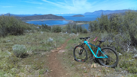 Klamath Lake from Klamath Ridgeview Trail. Klamath Falls, Oregon.
MB. Oregon: exit Klamath Falls, Moore Park Trail. Park at Molly’s. Nice, scenic little place. Lake, mountain views. Just keep your mouth shut, or else: or else swallow some bugs. Noseeums, or gnats? (Double negative?) Whatever they are, avoid the occasional cloud. So, go south on 97 about three miles to main. Go west (right) on main, up the hill left on rogers a block, right on cypress and the park is just past armour. UPDATE: Molly's is closed. Park at your own risk, I guess.
UPDATE: Park at Pilot. UPDATE: Cross the street, traverse Chevron's lot & the adjacent Pacific Pride unmanned fuel place and take Quarry, left on Lakeport, right on Montelius, right on Nevada, and down the hill & around the bend is the park. Go up to the parking area and on the right corner of the hillside is a nature path that connects to Klamath Ridgeview trail.
US-101
D. Oregon: exit 279 N. US-101, DePoe Bay. Tidal Raves. 11:00am – 9:00pm. 541-765-2995. Imagine scrambling out of your yacht after having been dashed against the rocks. Now look around. Other than the flotsam of yacht wreckage, that’s what the view is like at Tidal Raves. The food is spectacular as well. But sadly, no valet parking; you have to park on the street. That stretch of highway boasts the world’s smallest harbor (DePoe Bay) and the world’s shortest river (umm…Lincoln City maybe, who took these notes!).
D. Oregon: exit 279 N. US-101, DePoe Bay. Tidal Raves. 11:00am – 9:00pm. 541-765-2995. Imagine scrambling out of your yacht after having been dashed against the rocks. Now look around. Other than the flotsam of yacht wreckage, that’s what the view is like at Tidal Raves. The food is spectacular as well. But sadly, no valet parking; you have to park on the street. That stretch of highway boasts the world’s smallest harbor (DePoe Bay) and the world’s shortest river (umm…Lincoln City maybe, who took these notes!).
Depoe Bay, Oregon.
D, C, B. California: park at Pilot exit 326b southbound, 326c northbound. Salinas & Monterey. All over Salinas strapping homeless men can be seen paying homage to Steinbeck by heroically avoiding gainful employment. Together with the agriculture, the packing houses, and the trucks fighting for parking they help to preserve the Steinbeckian ambiance.
Walk a few blocks north (under the freeway) on Sanborn to east Alisal street, take bus from there to Monterey. Fine dining seems to be concentrated in the few blocks between your disembarkment at the Monterey Bus Plaza and Fisherman’s Wharf. Look (but not too hard ‘cause they’re everywhere) for Adventures by the Sea if you feel like tooling around in kayaks or bicycles (including tandems). Look for guides cleaning fish on the pier and I bet you’ll find a harbor seal (I saw one in such a location and also 3 or 4 playing near the beach).
UPDATE: So Fort Ord was decommissioned in 1994. The feds kept it and turned it into a National Monument (whatever the hell that designation means). Wikipedia (my go-to source for exhaustive, in-depth research), reports that the “endangered Smith’s blue butterfly” was the beneficiary of the first “nature reserve in the United States created for the conservation of an insect.” (Note boys and girls how I deftly rearranged sentences into fragments and inserted quotation marks to avoid plagiarism. Of course in the process I mangled whatever E.B. White had to say about style.)
Where the hell was I going with this? Oh yeah, amongst the unexploded ordinance there are biking/hiking trails to explore. (I don’t think I ran over any California Tiger Salamanders, another threatened species.) Fort Ord boasts fun, if annoying, stretches of fast flowing downhill segments. The annoying part is the unreasonable perspiration-boarding inflicted on poor riders struggling to get uphill (sure you could pedal up some of those hills, but why? Why weren’t a few switchbacks stitched into the trail).
Enough bad mouth. Ft. Ord is an infinitely better choice than hanging at the truck stop all day. I’d love to re-direct you to Torro Park, but they closed the gates to me for the Spartan Race (one of those obstacle, schlep through the mud races), so I have no experience about the trail. It is purported to be more challenging than Ft. Ord.
Heron & Harbor Seal. Monterey, California.
US-160/163
Arizona: exit Kayenta. McDonald’s Code-Talkers display. The only code the Nazi's couldn't break. Heroically intelligent.
US-191
MB, B. Utah: exit Moab. Park on the street. Slickrock Bike Trail. The granddaddy of all bike trails! This is where it all began. From the BLM’s Sand Flats Bike Trails brochure: “ This 10.5-mile loop crosses a scenic and rugged expanse of rolling Navajo Sandstone, the remnant of an ancient desert environment of wind blown sand dunes.” There is also a 1.7 mile practice loop which seems to me just as intense. During summer months the afternoon temps are hot enough to melt your fillings. Therefore, they strongly suggest riding early morning, or evening. And bring water. During winter months ice creeps in – hit a patch of that and goodbye yellow brick road (whatever that means). The BLM brochure says normal riding season is from mid Feb thru Nov. You can get there by bike from downtown, but I strongly recommend saving your energy for the trail and taking a shuttle (it’s 3 miles from town, 2 of which is steeply uphill). If you plan on riding early morning, I would call ahead to schedule a ride as I had trouble waking anybody (and thus know the details of riding up from downtown). The info center at Center & Main streets has maps and shuttle service phone numbers. I highly recommend Hazzard County Shuttle www.hazardcountyshuttle.com. A mere $15.00 smackaroos will get you picked up, subtly appraised (to gage if your gear is squared away), and deposited at the trailhead. Great deal, take it. There are other shuttles in the area, but this guy (Geoff) answers his phone. A few years ago, maybe many, I noticed the bike shop closest to the grocery store had shower amenities (I want to say $5.00, but I know it wasn’t more than $10.00). Oh, and make sure your brakes are in good working order.
The road into Moab, Utah.
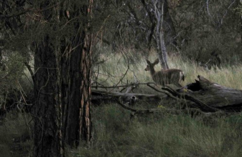 Heavily Retouched Photo of Guy I Nearly Bonded with. Susanville, Cal-if-or-ni-aye.
US-395
MB. California: exit Susanville. Susanville Ranch Park. So I was racing the sun down the hill, feeling in the flow, enjoying an aha! insight about the similarities between skiing and biking, when a large rock abruptly reminded me of the differences. Got a few souvenirs from that one, maybe some keepers – time will tell. Anyway, the embrace started to get awkward, so I pushed myself off the rock, got back on the bike and continued down the hill. On the straightaway I got a head of stream going and turned the corner onto the last bit of trail and nearly slammed broadside into a deer. We both startled and he bolted 25 yards up the hill before gaining his composure and staring at me. Hell of an outing not to have strapped on the faux-pro. Park on the street by McDonalds, or at the brake check area at the top of the hill. From McDonalds, go east on Main street then turn right on Roop road for two or three blocks and look for trailhead. Alternately, from brake check area head downhill (watch for cars, you’ll be on the highway) 2 miles and turn left on Roop road (may need to overshoot Roop & double back so as not to cause injury to self).
MB. California: exit Susanville. Susanville Ranch Park. So I was racing the sun down the hill, feeling in the flow, enjoying an aha! insight about the similarities between skiing and biking, when a large rock abruptly reminded me of the differences. Got a few souvenirs from that one, maybe some keepers – time will tell. Anyway, the embrace started to get awkward, so I pushed myself off the rock, got back on the bike and continued down the hill. On the straightaway I got a head of stream going and turned the corner onto the last bit of trail and nearly slammed broadside into a deer. We both startled and he bolted 25 yards up the hill before gaining his composure and staring at me. Hell of an outing not to have strapped on the faux-pro. Park on the street by McDonalds, or at the brake check area at the top of the hill. From McDonalds, go east on Main street then turn right on Roop road for two or three blocks and look for trailhead. Alternately, from brake check area head downhill (watch for cars, you’ll be on the highway) 2 miles and turn left on Roop road (may need to overshoot Roop & double back so as not to cause injury to self).
US-20
B, C. Wyoming: exit Thermopolis. Park at Shell Southside Travel Center (south of town). Hot Springs State Park is home to the world’s largest mineral hot springs. I imagine the 104° pools feel pretty awesome come wintertime in Wyoming. Or, even on an average Wyoming day. Coincidentally, 104° was the average temperature in my cab that week. So, I skipped the dip. But, should you dip, there are a few options, including the free public state bathhouse. Dry, the park is still worth the trip. Interesting things grow in the water weeping from the ground. Roads loop around Buffalo ranges and make for nice cruising.
B, C. Wyoming: exit Thermopolis. Park at Shell Southside Travel Center (south of town). Hot Springs State Park is home to the world’s largest mineral hot springs. I imagine the 104° pools feel pretty awesome come wintertime in Wyoming. Or, even on an average Wyoming day. Coincidentally, 104° was the average temperature in my cab that week. So, I skipped the dip. But, should you dip, there are a few options, including the free public state bathhouse. Dry, the park is still worth the trip. Interesting things grow in the water weeping from the ground. Roads loop around Buffalo ranges and make for nice cruising.
Mineral Hot Springs State Park, Thermopolis, Wyoming
Hairy. Thermopolis, Wyoming
|
|
|
California 158
MB. Park at the brake-check pullout on the eastbound side at the summit. Plenty of space. Pacheo State Park is very popular amongst the bovine crowd. Gigantic rolling hills, ancient knarled oak trees. Bucholic. Nice double track (unused dirt road) with challenging slalom courses featuring organic obstacles. Good place to pair a workout with bombing madly downhill (then repeat). I visited in the winter, but I would bet if you timed it right in the spring the hills would be alive with the sound of wildflowers, especially California Poppies. Beautiful, bucholic, botanical, and alliterative.
MB. Park at the brake-check pullout on the eastbound side at the summit. Plenty of space. Pacheo State Park is very popular amongst the bovine crowd. Gigantic rolling hills, ancient knarled oak trees. Bucholic. Nice double track (unused dirt road) with challenging slalom courses featuring organic obstacles. Good place to pair a workout with bombing madly downhill (then repeat). I visited in the winter, but I would bet if you timed it right in the spring the hills would be alive with the sound of wildflowers, especially California Poppies. Beautiful, bucholic, botanical, and alliterative.
Oregon 126
MB. Park at the Blazing Saddles Bike Shop/Quilt Shop (be sure to ask just in case). Castle Rock Mountain Bike Trail.
Washington 18
MB. Pull onto the pullout at the top of Tiger Mountain pass (northbound). Play Frogger to the opposite side. Try not to lose, no resets in this game. In full disclosure, I didn’t make it to the summit (dag gummit) but I came a hell of a lot closer than I thought I would’ve when I started. Nice mixture of technical, fast flowing, grinding, etc. Rode in the rain, but the trees filtered out a lot of the moisture and the trails are hard packed, so I didn’t tear up the place.
|
|
|
